Cape Ann%27s Marina,
MA
04/19/2024 10:00 PM
46°F
TEMPERATURE
Winds 13 mph S
Mostly Cloudy
A chance of rain showers between 2am and 5am, then a chance of rain showers and patchy fog. Cloudy, with a low around 45. South wind 9 to 13 mph. Chance of precipitation is 50%. New rainfall amounts less than a tenth of an inch possible.
Moonrise
04:22 PM
Moonset
05:17 AM
Sunrise
05:52 AM
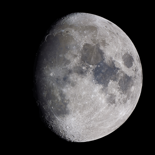
Moon Phase
Waxing gibbous
Sunset
07:30 PM
Hourly Forecast
Fri, 10:00 PM
Mostly CloudyWinds: 13 mph S
46°
Fri, 11:00 PM
Mostly CloudyWinds: 12 mph S
46°
Sat, 12:00 AM
Mostly CloudyWinds: 12 mph S
46°
Sat, 01:00 AM
CloudyWinds: 12 mph S
46°
Sat, 02:00 AM
Slight Chance Rain ShowersWinds: 12 mph S
46°
Sat, 03:00 AM
Chance Rain ShowersWinds: 10 mph S
45°
Sat, 04:00 AM
Chance Rain ShowersWinds: 10 mph S
45°
Sat, 05:00 AM
Chance Rain ShowersWinds: 9 mph S
45°
Sat, 06:00 AM
Rain Showers LikelyWinds: 9 mph S
46°
Sat, 07:00 AM
Rain ShowersWinds: 9 mph S
47°
Sat, 08:00 AM
Rain ShowersWinds: 8 mph SW
48°
Sat, 09:00 AM
Rain ShowersWinds: 8 mph SW
50°
Sat, 10:00 AM
Rain ShowersWinds: 8 mph SW
51°
Sat, 11:00 AM
Rain Showers LikelyWinds: 8 mph W
53°
Sat, 12:00 PM
Rain Showers LikelyWinds: 8 mph W
54°
Sat, 01:00 PM
Chance Rain ShowersWinds: 9 mph SW
55°
Sat, 02:00 PM
Slight Chance Rain ShowersWinds: 9 mph SW
55°
Sat, 03:00 PM
Slight Chance Rain ShowersWinds: 9 mph SW
56°
Sat, 04:00 PM
Partly SunnyWinds: 9 mph SW
56°
Sat, 05:00 PM
Partly SunnyWinds: 9 mph SW
55°
Sat, 06:00 PM
Mostly CloudyWinds: 10 mph SW
55°
Sat, 07:00 PM
Mostly CloudyWinds: 10 mph W
53°
Sat, 08:00 PM
Slight Chance Rain ShowersWinds: 10 mph W
51°
Sat, 09:00 PM
Slight Chance Rain ShowersWinds: 12 mph W
50°
Winds: 9 to 13 mph S
A chance of rain showers between 2am and 5am, then a chance of rain showers and patchy fog. Cloudy, with a low around 45. South wind 9 to 13 mph. Chance of precipitation is 50%. New rainfall amounts less than a tenth of an inch possible.
Winds: 9 mph SW
Rain showers and patchy fog before 4pm. Mostly cloudy, with a high near 59. Southwest wind around 9 mph. Chance of precipitation is 100%. New rainfall amounts between a quarter and half of an inch possible.
Winds: 10 to 14 mph W
A chance of rain showers between 8pm and midnight. Partly cloudy, with a low around 40. West wind 10 to 14 mph. Chance of precipitation is 30%.
Winds: 13 mph W
Sunny, with a high near 57. West wind around 13 mph.
Winds: 13 mph W
Mostly clear, with a low around 40. West wind around 13 mph.
Winds: 10 to 14 mph W
Sunny, with a high near 53. West wind 10 to 14 mph.
Winds: 12 mph NW
Mostly clear, with a low around 37. Northwest wind around 12 mph.
Winds: 9 to 17 mph S
Mostly sunny, with a high near 54. South wind 9 to 17 mph.
Winds: 18 mph S
Mostly cloudy, with a low around 43. South wind around 18 mph.
Winds: 16 to 20 mph S
A slight chance of rain showers before 8am, then a chance of rain. Mostly cloudy, with a high near 57. South wind 16 to 20 mph. Chance of precipitation is 40%.
Winds: 20 mph SW
A chance of rain. Mostly cloudy, with a low around 36. Southwest wind around 20 mph. Chance of precipitation is 40%.
Winds: 15 to 18 mph W
A slight chance of rain before 10am. Mostly sunny, with a high near 53. West wind 15 to 18 mph.
Winds: 15 mph NW
Mostly clear, with a low around 37. Northwest wind around 15 mph.
Winds: 14 mph NW
Sunny, with a high near 53. Northwest wind around 14 mph.
Coastal Waters Forecast for Massachusetts and Rhode Island
National Weather Service Boston/Norton MA
for Massachusetts and Rhode Island coastal waters. High pres over the waters south of Nova Scotia continues to move eastward tonight. A cold front then brings showers and a period of breezy conditions for Sat. High pres then returns for Sun and Mon, though with W to NW breezes.
Coastal waters from the Merrimack River MA to Watch Hill RI out to 25 NM
OVERNIGHT
S winds around 10 kt with gusts up to 20 kt Seas 3 to 4 ft Wave Detail: SE 3 ft at 4 seconds and E 1 ft at 11 seconds Patchy fog A chance of showers
SAT
SW winds 5 to 10 kt Gusts up to 20 kt in the morning Seas 2 to 4 ft Wave Detail: S 3 ft at 4 seconds and E 1 ft at 4 seconds Patchy fog Showers in the morning A chance of showers in the afternoon Vsby 1 NM or less
SAT NIGHT
W winds 10 to 15 kt with gusts up to 25 kt Seas 2 to 4 ft Wave Detail: W 3 ft at 4 seconds and SE 2 ft at 5 seconds A chance of showers in the evening with vsby 1 to 3 NM
SUN
W winds 10 to 15 kt with gusts up to 20 kt, becoming SW in the afternoon Seas 2 to 4 ft Wave Detail: W 3 ft at 4 seconds and SE 2 ft at 6 seconds
SUN NIGHT
W winds 10 to 15 kt with gusts up to 20 kt Seas 2 to 3 ft Wave Detail: SW 2 ft at 4 seconds and SE 2 ft at 7 seconds
MON AND MON NIGHT
N winds 10 to 15 kt with gusts up to 20 kt Seas 2 to 3 ft
TUE AND TUE NIGHT
S winds 15 to 20 kt with gusts up to 25 kt Seas 2 to 4 ft
WED AND WED NIGHT
S winds around 15 kt, becoming SW Gusts up to 30 kt Seas 3 to 5 ft A chance of rain
OVERNIGHT
S winds around 10 kt Gusts up to 20 kt Seas 2 to 3 ft Wave Detail: S 3 ft at 4 seconds and E 2 ft at 4 seconds Patchy fog A chance of showers
SAT
SW winds 5 to 10 kt Seas 2 to 3 ft Wave Detail: S 2 ft at 4 seconds and E 1 ft at 5 seconds Patchy fog Showers in the morning A chance of showers in the afternoon Vsby 1 to 3 NM
SAT NIGHT
W winds 10 to 15 kt with gusts up to 25 kt Seas around 2 ft Wave Detail: W 2 ft at 3 seconds and SE 1 ft at 5 seconds A chance of showers in the evening
SUN
W winds 10 to 15 kt Gusts up to 20 kt in the morning Seas around 2 ft Wave Detail: W 2 ft at 3 seconds and SE 1 ft at 6 seconds
SUN NIGHT
W winds 10 to 15 kt, increasing to 15 to 20 kt after midnight Seas around 2 ft Wave Detail: W 2 ft at 3 seconds and SE 1 ft at 6 seconds
MON AND MON NIGHT
NW winds 15 to 20 kt Seas around 2 ft
TUE AND TUE NIGHT
S winds 10 to 15 kt with gusts up to 25 kt Seas 2 to 3 ft
WED AND WED NIGHT
S winds around 15 kt, becoming W Gusts up to 25 kt Seas 2 to 4 ft A chance of rain
OVERNIGHT
S winds 5 to 10 kt Seas around 2 ft Wave Detail: E 1 ft at 3 seconds and S 1 ft at 3 seconds Patchy fog A chance of showers with vsby 1 to 3 NM
SAT
SW winds 5 to 10 kt Seas around 2 ft Wave Detail: S 2 ft at 4 seconds and E 1 ft at 4 seconds Patchy fog Showers Vsby 1 to 3 NM, decreasing to 1 NM or less in the afternoon
SAT NIGHT
W winds 10 to 15 kt with gusts up to 25 kt Seas around 2 ft Wave Detail: W 2 ft at 3 seconds and SE 1 ft at 6 seconds
SUN
W winds 10 to 15 kt with gusts up to 20 kt, becoming SW in the afternoon Seas around 2 ft Wave Detail: NW 2 ft at 4 seconds and SE 1 ft at 6 seconds
SUN NIGHT
SW winds around 10 kt Seas around 2 ft Wave Detail: SW 1 ft at 3 seconds and SE 1 ft at 6 seconds
MON AND MON NIGHT
N winds 10 to 15 kt Seas around 2 ft
TUE AND TUE NIGHT
S winds 10 to 15 kt with gusts up to 20 kt Seas around 2 ft
WED
S winds around 15 kt with gusts up to 25 kt Seas around 2 ft A chance of rain
WED NIGHT
W winds around 15 kt with gusts up to 25 kt Seas 2 to 4 ft A chance of rain
OVERNIGHT
S winds around 10 kt Seas 3 to 4 ft Wave Detail: SE 4 ft at 5 seconds and E 2 ft at 11 seconds Patchy fog A chance of showers with vsby 1 to 3 NM
SAT
S winds around 10 kt, becoming SW in the afternoon Seas 2 to 4 ft Wave Detail: S 3 ft at 4 seconds and E 2 ft at 11 seconds Patchy fog Showers likely Vsby 1 NM or less
SAT NIGHT
W winds 10 to 15 kt with gusts up to 25 kt Seas 2 to 4 ft Wave Detail: NW 3 ft at 4 seconds and SE 3 ft at 6 seconds Patchy fog in the evening with vsby 1 to 3 NM
SUN
NW winds 10 to 15 kt with gusts up to 20 kt, becoming SW in the afternoon Seas 3 to 4 ft Wave Detail: NW 3 ft at 4 seconds and SE 2 ft at 6 seconds
SUN NIGHT
W winds 10 to 15 kt Seas 2 to 4 ft Wave Detail: S 2 ft at 5 seconds and E 1 ft at 11 seconds
MON AND MON NIGHT
E winds 10 to 15 kt with gusts up to 20 kt Seas 2 to 3 ft
TUE THROUGH WED
S winds 10 to 15 kt with gusts up to 25 kt Seas 2 to 4 ft
WED NIGHT
SW winds around 15 kt with gusts up to 25 kt Seas 4 to 5 ft A chance of rain
OVERNIGHT
SE winds 5 to 10 kt Seas 3 to 4 ft Wave Detail: SE 4 ft at 7 seconds and E 1 ft at 4 seconds Patchy fog A chance of showers with vsby 1 to 3 NM
SAT
S winds 5 to 10 kt, becoming W in the afternoon Seas 2 to 4 ft Wave Detail: SE 4 ft at 6 seconds and W 2 ft at 4 seconds Patchy fog A chance of showers in the morning Showers likely in the afternoon Vsby 1 NM or less
SAT NIGHT
W winds 10 to 15 kt with gusts up to 25 kt Seas 2 to 4 ft Wave Detail: W 3 ft at 5 seconds and SE 3 ft at 7 seconds Patchy fog in the evening A chance of showers in the evening with vsby 1 to 3 NM
SUN
NW winds 10 to 15 kt, becoming W 15 to 20 kt in the afternoon Gusts up to 25 kt Seas 2 to 4 ft Wave Detail: W 3 ft at 5 seconds and SE 2 ft at 6 seconds
SUN NIGHT AND MON
W winds 15 to 20 kt with gusts up to 25 kt Seas 2 to 4 ft Wave Detail: W 3 ft at 5 seconds and SE 2 ft at 7 seconds
MON NIGHT
S winds 5 to 10 kt, becoming E after midnight Seas around 2 ft
TUE THROUGH WED
S winds 10 to 15 kt with gusts up to 25 kt Seas 2 to 4 ft
WED NIGHT
W winds around 15 kt with gusts up to 25 kt Seas 3 to 5 ft A chance of rain
OVERNIGHT
S winds 5 to 10 kt Seas around 4 ft Wave Detail: SE 4 ft at 7 seconds and E 1 ft at 11 seconds Patchy fog A chance of showers with vsby 1 to 3 NM
SAT
SW winds 5 to 10 kt Seas 3 to 4 ft Wave Detail: SE 3 ft at 7 seconds and W 2 ft at 4 seconds Patchy fog Showers likely, mainly in the morning Vsby 1 NM or less, increasing to 1 to 3 NM in the afternoon
SAT NIGHT
W winds 10 to 15 kt with gusts up to 25 kt Seas 3 to 4 ft Wave Detail: W 3 ft at 4 seconds and SE 3 ft at 7 seconds
SUN
NW winds 10 to 15 kt, becoming W 15 to 20 kt in the afternoon Gusts up to 25 kt Seas 2 to 4 ft Wave Detail: NW 3 ft at 4 seconds and SE 2 ft at 7 seconds
SUN NIGHT AND MON
W winds 15 to 20 kt with gusts up to 25 kt Seas 2 to 4 ft Wave Detail: W 3 ft at 4 seconds and SE 2 ft at 7 seconds
MON NIGHT
W winds around 10 kt, becoming N after midnight Seas around 2 ft
TUE AND TUE NIGHT
SE winds 10 to 15 kt with gusts up to 20 kt Seas 2 to 3 ft
WED AND WED NIGHT
S winds around 15 kt, becoming W Gusts up to 25 kt Seas 3 to 5 ft A chance of rain
OVERNIGHT
S winds 5 to 10 kt Seas around 2 ft Wave Detail: S 2 ft at 4 seconds and E 1 ft at 4 seconds Patchy fog A chance of showers with vsby 1 to 3 NM
SAT
SW winds 5 to 10 kt Seas around 2 ft Wave Detail: SW 2 ft at 4 seconds and E 1 ft at 5 seconds Patchy fog Showers likely Vsby 1 NM or less
SAT NIGHT
W winds 10 to 15 kt with gusts up to 25 kt Seas around 2 ft Wave Detail: W 2 ft at 4 seconds and SE 1 ft at 6 seconds Patchy fog in the evening with vsby 1 to 3 NM
SUN
W winds 10 to 15 kt, becoming SW 15 to 20 kt in the afternoon Seas 2 to 3 ft Wave Detail: W 2 ft at 3 seconds and SE 1 ft at 6 seconds
SUN NIGHT
SW winds 15 to 20 kt, becoming W 10 to 15 kt after midnight Seas 2 to 3 ft Wave Detail: W 2 ft at 3 seconds and SE 1 ft at 6 seconds
MON AND MON NIGHT
N winds 10 to 15 kt Seas 1 foot or less
TUE THROUGH WED
S winds 10 to 15 kt with gusts up to 25 kt Seas 2 to 3 ft
WED NIGHT
W winds around 15 kt with gusts up to 25 kt Seas 2 to 3 ft A chance of rain
OVERNIGHT
S winds 5 to 10 kt Seas around 2 ft Wave Detail: S 2 ft at 6 seconds and S 1 ft at 3 seconds Patchy fog A chance of showers with vsby 1 to 3 NM
SAT
SW winds 5 to 10 kt Seas around 2 ft Wave Detail: SW 2 ft at 4 seconds and SE 2 ft at 6 seconds Patchy fog Showers Vsby 1 to 3 NM
SAT NIGHT
W winds 10 to 15 kt with gusts up to 20 kt Seas around 2 ft Wave Detail: W 2 ft at 4 seconds and S 2 ft at 7 seconds
SUN
W winds 10 to 15 kt, becoming SW 20 to 25 kt in the afternoon Seas 2 to 4 ft Wave Detail: W 2 ft at 4 seconds and S 1 ft at 7 seconds
SUN NIGHT AND MON
W winds 15 to 20 kt with gusts up to 25 kt Seas 2 to 4 ft Wave Detail: SW 2 ft at 4 seconds and S 1 ft at 7 seconds
MON NIGHT
SW winds around 10 kt, becoming N after midnight Seas 1 foot or less
TUE AND TUE NIGHT
S winds 10 to 15 kt with gusts up to 20 kt Seas 1 foot or less, then around 2 ft
WED AND WED NIGHT
S winds around 15 kt, becoming W Gusts up to 25 kt Seas 2 to 4 ft A chance of rain
OVERNIGHT
S winds 5 to 10 kt Seas around 2 ft Wave Detail: S 2 ft at 4 seconds and SE 1 ft at 3 seconds Patchy fog A chance of showers with vsby 1 to 3 NM
SAT
SW winds 5 to 10 kt Seas around 2 ft Wave Detail: SW 2 ft at 3 seconds and SE 2 ft at 6 seconds Patchy fog Showers Vsby 1 to 3 NM
SAT NIGHT
W winds 10 to 15 kt with gusts up to 20 kt Seas around 2 ft Wave Detail: SW 2 ft at 5 seconds and E 1 ft at 5 seconds
SUN
W winds around 10 kt, becoming SW 20 to 25 kt in the afternoon Seas 2 to 4 ft Wave Detail: W 2 ft at 4 seconds and SE 1 ft at 6 seconds
SUN NIGHT AND MON
W winds 15 to 20 kt with gusts up to 25 kt Seas 2 to 4 ft Wave Detail: SW 2 ft at 4 seconds and SE 1 ft at 7 seconds
MON NIGHT
SW winds around 10 kt, becoming N after midnight Seas 1 foot or less
TUE AND TUE NIGHT
S winds 10 to 15 kt with gusts up to 20 kt Seas 1 foot or less, then around 2 ft
WED AND WED NIGHT
S winds around 15 kt, becoming W Gusts up to 25 kt Seas 2 to 4 ft A chance of rain
OVERNIGHT
S winds 5 to 10 kt Seas 2 to 3 ft Wave Detail: SE 3 ft at 7 seconds and SE 1 ft at 14 seconds Patchy fog A chance of showers with vsby 1 to 3 NM
SAT
SW winds 5 to 10 kt Seas 2 to 3 ft Wave Detail: SE 3 ft at 7 seconds and SW 2 ft at 4 seconds Patchy fog Showers in the morning A chance of showers in the afternoon Vsby 1 to 3 NM
SAT NIGHT
W winds 10 to 15 kt with gusts up to 25 kt Seas 2 to 3 ft Wave Detail: W 3 ft at 4 seconds and SE 2 ft at 7 seconds
SUN
W winds 10 to 15 kt, becoming SW 20 to 25 kt in the afternoon Seas 2 to 3 ft Wave Detail: W 2 ft at 4 seconds and SE 2 ft at 7 seconds
SUN NIGHT AND MON
W winds 15 to 20 kt with gusts up to 25 kt Seas 2 to 3 ft Wave Detail: W 2 ft at 4 seconds and SE 2 ft at 7 seconds
MON NIGHT
W winds around 10 kt, becoming N after midnight Seas around 2 ft
TUE AND TUE NIGHT
S winds 10 to 15 kt with gusts up to 20 kt Seas 2 to 3 ft
WED AND WED NIGHT
S winds around 15 kt, becoming W Gusts up to 25 kt Seas 2 to 4 ft A chance of rain
OVERNIGHT
S winds 5 to 10 kt Seas 2 to 3 ft Wave Detail: SE 3 ft at 7 seconds and E 1 ft at 3 seconds Patchy fog A chance of showers with vsby 1 to 3 NM
SAT
SW winds 5 to 10 kt Seas 2 to 3 ft Wave Detail: SE 3 ft at 7 seconds and W 2 ft at 3 seconds Patchy fog Showers likely, mainly in the morning Vsby 1 NM or less, increasing to 1 to 3 NM in the afternoon
SAT NIGHT
W winds 10 to 15 kt with gusts up to 30 kt Seas 2 to 3 ft Wave Detail: W 2 ft at 4 seconds and SE 2 ft at 7 seconds
SUN
W winds 10 to 15 kt with gusts up to 20 kt Seas 2 to 3 ft Wave Detail: W 2 ft at 3 seconds and SE 2 ft at 7 seconds
SUN NIGHT AND MON
W winds 10 to 15 kt with gusts up to 20 kt Seas 2 to 3 ft Wave Detail: W 2 ft at 4 seconds and SE 2 ft at 7 seconds
MON NIGHT
W winds around 10 kt, becoming N after midnight Seas around 2 ft in the evening, then 1 foot or less
TUE AND TUE NIGHT
SE winds 5 to 10 kt, becoming S 10 to 15 kt Gusts up to 20 kt Seas 2 to 3 ft
WED AND WED NIGHT
S winds around 15 kt, becoming W Gusts up to 25 kt Seas 2 to 4 ft A chance of rain
OVERNIGHT
S winds 5 to 10 kt Waves 1 foot or less Patchy fog A chance of showers
SAT
SW winds 5 to 10 kt Waves 1 foot or less Patchy fog Showers Vsby 1 to 3 NM
SAT NIGHT
W winds 10 to 15 kt with gusts up to 20 kt Waves around 2 ft A chance of showers in the evening
SUN
W winds 10 to 15 kt, increasing to 15 to 20 kt in the afternoon Waves around 2 ft
SUN NIGHT
W winds 10 to 15 kt, increasing to 15 to 20 kt after midnight Waves around 2 ft
MON AND MON NIGHT
W winds 15 to 20 kt Waves around 2 ft
TUE AND TUE NIGHT
S winds 10 to 15 kt with gusts up to 20 kt Waves around 2 ft
WED AND WED NIGHT
S winds around 15 kt, becoming W Gusts up to 25 kt Waves around 2 ft A chance of rain
OVERNIGHT
S winds 5 to 10 kt Waves around 2 ft Patchy fog A chance of showers with vsby 1 to 3 NM
SAT
SW winds 5 to 10 kt Waves around 2 ft Patchy fog Showers Vsby 1 NM or less, increasing to 1 to 3 NM in the afternoon
SAT NIGHT
W winds 10 to 15 kt with gusts up to 20 kt Waves around 2 ft
SUN
W winds around 10 kt, becoming SW 15 to 20 kt in the afternoon Waves 2 to 3 ft
SUN NIGHT AND MON
W winds 10 to 15 kt with gusts up to 20 kt Waves 2 to 3 ft
MON NIGHT
W winds around 10 kt, becoming NW after midnight Waves 1 foot or less
TUE AND TUE NIGHT
S winds 10 to 15 kt with gusts up to 20 kt Waves around 2 ft
WED AND WED NIGHT
S winds 10 to 15 kt, becoming W Gusts up to 25 kt Waves 2 to 3 ft A chance of rain
Oilrig
NWS
Buoy
Fixed Station
USGS
Ship
Other


Search Results
