Yarmouth Port
MA
07/02/2025 05:00 PM
78°F
TEMPERATURE
Winds 10 mph SW
Cloudy
Cloudy, with a high near 81. Southwest wind around 10 mph.
Moonrise
01:52 PM
Moonset
01:02 AM
Sunrise
05:10 AM
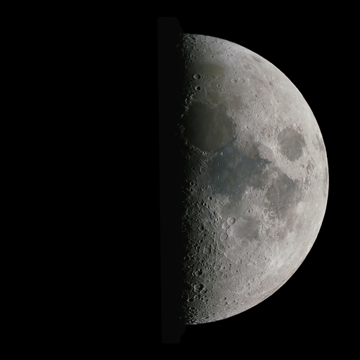
Moon Phase
First quarter
Sunset
08:19 PM
Hourly Forecast
Wed, 05:00 PM
CloudyWinds: 10 mph SW
78°
Wed, 06:00 PM
CloudyWinds: 10 mph SW
77°
Wed, 07:00 PM
CloudyWinds: 10 mph SW
75°
Wed, 08:00 PM
CloudyWinds: 9 mph SW
73°
Wed, 09:00 PM
CloudyWinds: 9 mph SW
72°
Wed, 10:00 PM
Areas Of FogWinds: 8 mph SW
71°
Wed, 11:00 PM
Areas Of FogWinds: 7 mph SW
70°
Thu, 12:00 AM
Areas Of FogWinds: 7 mph SW
69°
Thu, 01:00 AM
Areas Of FogWinds: 6 mph SW
68°
Thu, 02:00 AM
Areas Of FogWinds: 5 mph SW
67°
Thu, 03:00 AM
Areas Of FogWinds: 5 mph SW
67°
Thu, 04:00 AM
Areas Of FogWinds: 5 mph SW
67°
Thu, 05:00 AM
Areas Of FogWinds: 5 mph SW
67°
Thu, 06:00 AM
Areas Of FogWinds: 6 mph SW
68°
Thu, 07:00 AM
Partly SunnyWinds: 6 mph SW
70°
Thu, 08:00 AM
Partly SunnyWinds: 6 mph SW
72°
Thu, 09:00 AM
Mostly SunnyWinds: 7 mph SW
74°
Thu, 10:00 AM
Mostly SunnyWinds: 7 mph W
76°
Thu, 11:00 AM
SunnyWinds: 8 mph W
79°
Thu, 12:00 PM
SunnyWinds: 8 mph W
81°
Thu, 01:00 PM
SunnyWinds: 8 mph SW
82°
Thu, 02:00 PM
SunnyWinds: 8 mph SW
84°
Thu, 03:00 PM
SunnyWinds: 9 mph SW
84°
Thu, 04:00 PM
SunnyWinds: 10 mph SW
83°
Winds: 10 mph SW
Cloudy, with a high near 81. Southwest wind around 10 mph.
Winds: 5 to 10 mph SW
Areas of fog after 10pm. Mostly cloudy, with a low around 66. Southwest wind 5 to 10 mph.
Winds: 6 to 12 mph SW
Areas of fog before 7am, then a slight chance of rain showers. Mostly sunny, with a high near 86. Southwest wind 6 to 12 mph. Chance of precipitation is 20%.
Winds: 5 to 12 mph W
A chance of rain showers before 8pm, then a chance of showers and thunderstorms between 8pm and 10pm, then a slight chance of showers and thunderstorms between 10pm and 11pm. Mostly cloudy, with a low around 63. West wind 5 to 12 mph. Chance of precipitation is 40%.
Winds: 6 to 9 mph N
Sunny, with a high near 80. North wind 6 to 9 mph.
Winds: 6 mph SW
Mostly clear, with a low around 64. Southwest wind around 6 mph.
Winds: 5 to 9 mph W
Sunny, with a high near 82. West wind 5 to 9 mph.
Winds: 9 mph SW
Partly cloudy, with a low around 67. Southwest wind around 9 mph.
Winds: 9 to 15 mph SW
Mostly sunny, with a high near 82. Southwest wind 9 to 15 mph.
Winds: 14 mph SW
Mostly clear, with a low around 69. Southwest wind around 14 mph.
Winds: 10 to 16 mph SW
Sunny, with a high near 84. Southwest wind 10 to 16 mph.
Winds: 9 to 14 mph SW
Partly cloudy, with a low around 71. Southwest wind 9 to 14 mph.
Winds: 9 to 13 mph SW
A slight chance of rain showers between 8am and 2pm, then a slight chance of showers and thunderstorms. Partly sunny, with a high near 83. Southwest wind 9 to 13 mph.
Winds: 6 to 10 mph SW
A slight chance of showers and thunderstorms before 8pm, then a chance of showers and thunderstorms. Mostly cloudy, with a low around 69. Southwest wind 6 to 10 mph.
Coastal Waters Forecast for Massachusetts and Rhode Island
National Weather Service Boston/Norton MA
for Massachusetts and Rhode Island coastal waters. Cold front slowly moves offshore tonight. Another cold front moves through late Thu into early Fri with potential for a few showers and storms over the waters. High pres into this weekend into next week.
Coastal waters from the Merrimack River MA to Watch Hill RI out to 25 NM
TONIGHT
SW winds 10 to 15 kt, diminishing to 5 to 10 kt after midnight Gusts up to 20 kt Seas 2 to 3 ft Wave Detail: SW 2 ft at 4 seconds and E 2 ft at 8 seconds Areas of fog Vsby 1 to 3 NM after midnight
THU
SW winds 5 to 10 kt, becoming S in the afternoon Seas 2 to 3 ft Wave Detail: SE 2 ft at 9 seconds and SW 1 foot at 4 seconds Areas of fog in the morning A chance of showers and tstms in the afternoon Some tstms may produce gusty winds and small hail in the afternoon Vsby 1 NM or less in the morning
THU NIGHT
W winds around 10 kt, becoming NW after midnight Seas 2 to 3 ft Wave Detail: S 2 ft at 7 seconds and SE 2 ft at 9 seconds A chance of showers in the evening
FRI
NW winds 5 to 10 kt Seas 2 to 3 ft Wave Detail: NW 2 ft at 3 seconds and SE 2 ft at 7 seconds
FRI NIGHT
W winds 5 to 10 kt, becoming NW after midnight Seas 2 to 3 ft Wave Detail: SE 2 ft at 8 seconds and S 1 foot at 3 seconds
SAT AND SAT NIGHT
SW winds 10 to 15 kt with gusts up to 20 kt Seas 2 to 3 ft Wave Detail: S 3 ft at 4 seconds and SE 2 ft at 8 seconds
SUN THROUGH MON NIGHT
SW winds 15 to 20 kt with gusts up to 30 kt Seas 2 to 4 ft
TONIGHT
SW winds 5 to 10 kt Seas around 2 ft Wave Detail: E 2 ft at 8 seconds and SW 1 foot at 3 seconds Areas of fog after midnight with vsby 1 to 3 NM
THU
W winds around 5 kt, becoming S in the afternoon Seas around 2 ft Wave Detail: E 2 ft at 8 seconds and SW 1 foot at 3 seconds A chance of showers and tstms in the afternoon Some tstms may produce gusty winds and small hail in the afternoon
THU NIGHT
W winds 5 to 10 kt Seas around 2 ft Wave Detail: E 2 ft at 9 seconds and SW 1 foot at 3 seconds A chance of showers and tstms in the evening Some tstms may produce gusty winds and small hail in the evening
FRI
NW winds 5 to 10 kt Seas around 2 ft Wave Detail: NW 1 foot at 2 seconds and S 1 foot at 4 seconds
FRI NIGHT
NW winds 5 to 10 kt Seas around 2 ft Wave Detail: NW 1 foot at 2 seconds and S 1 foot at 4 seconds
SAT AND SAT NIGHT
SW winds 10 to 15 kt with gusts up to 20 kt Seas around 2 ft Wave Detail: S 2 ft at 3 seconds and NW 1 foot at 2 seconds
SUN THROUGH MON NIGHT
SW winds 15 to 20 kt with gusts up to 25 kt Seas 2 to 3 ft
TONIGHT
SW winds 5 to 10 kt Gusts up to 20 kt this evening Seas around 2 ft Wave Detail: SW 1 foot at 3 seconds and E 1 foot at 8 seconds Areas of fog A slight chance of showers this evening Vsby 1 to 3 NM
THU
SW winds 5 to 10 kt Gusts up to 20 kt in the afternoon Seas 1 foot or less, then around 2 ft in the afternoon Wave Detail: SW 1 foot at 3 seconds and E 1 foot at 8 seconds Areas of fog in the morning with vsby 1 NM or less
THU NIGHT
W winds 5 to 10 kt, becoming NW after midnight Seas around 2 ft Wave Detail: W 1 foot at 2 seconds and S 1 foot at 5 seconds A chance of showers in the evening
FRI
NW winds 5 to 10 kt, becoming NE in the afternoon Seas around 2 ft Wave Detail: NW 1 foot at 3 seconds and S 1 foot at 7 seconds
FRI NIGHT
SW winds 5 to 10 kt, becoming NW after midnight Seas 1 foot or less Wave Detail: NW 1 foot at 3 seconds and S 1 foot at 4 seconds
SAT AND SAT NIGHT
SW winds 10 to 15 kt with gusts up to 20 kt Seas around 2 ft Wave Detail: NW 1 foot at 3 seconds and S 1 foot at 7 seconds
SUN THROUGH MON NIGHT
SW winds 15 to 20 kt with gusts up to 25 kt Seas 2 to 4 ft
TONIGHT
SW winds 5 to 10 kt with gusts up to 20 kt Seas 2 to 4 ft Wave Detail: S 3 ft at 7 seconds and E 2 ft at 8 seconds Areas of fog A slight chance of showers Vsby 1 NM or less
THU
SW winds 5 to 10 kt Gusts up to 20 kt in the afternoon Seas 2 to 3 ft Wave Detail: S 3 ft at 7 seconds and W 1 foot at 3 seconds Areas of fog Vsby 1 NM or less
THU NIGHT
SW winds around 10 kt with gusts up to 20 kt, becoming W after midnight Seas 2 to 4 ft Wave Detail: S 3 ft at 7 seconds and W 1 foot at 3 seconds Patchy fog in the evening with vsby 1 NM or less
FRI
NW winds 5 to 10 kt Seas 2 to 4 ft Wave Detail: S 3 ft at 8 seconds and E 2 ft at 8 seconds
FRI NIGHT
SW winds 5 to 10 kt, becoming W after midnight Seas 2 to 3 ft Wave Detail: S 2 ft at 7 seconds and SE 2 ft at 8 seconds
SAT AND SAT NIGHT
SW winds 10 to 15 kt with gusts up to 20 kt Seas 2 to 3 ft Wave Detail: S 2 ft at 7 seconds and SE 2 ft at 8 seconds
SUN THROUGH MON NIGHT
SW winds 15 to 20 kt with gusts up to 25 kt Seas 2 to 4 ft
SMALL CRAFT ADVISORY IN EFFECT UNTIL 8 PM EDT THIS EVENING
SMALL CRAFT ADVISORY IN EFFECT UNTIL 8 PM EDT THIS EVENING
TONIGHT
SW winds 5 to 10 kt with gusts up to 20 kt Seas 2 to 3 ft Wave Detail: SW 2 ft at 6 seconds and W 1 foot at 3 seconds Areas of fog Vsby 1 to 3 NM, decreasing to 1 NM or less after midnight
THU
SW winds 5 to 10 kt Gusts up to 20 kt in the afternoon Seas around 2 ft Wave Detail: SE 2 ft at 7 seconds and W 1 foot at 2 seconds Areas of fog in the morning with vsby 1 NM or less
THU NIGHT
W winds around 10 kt with gusts up to 20 kt, becoming NW after midnight Seas 2 to 3 ft Wave Detail: S 2 ft at 7 seconds and W 1 foot at 3 seconds A chance of showers in the evening
FRI
NW winds 5 to 10 kt, becoming E in the afternoon Seas around 2 ft Wave Detail: NW 1 foot at 2 seconds and S 1 foot at 7 seconds
FRI NIGHT
SW winds 5 to 10 kt, becoming NW after midnight Seas around 2 ft Wave Detail: NW 1 foot at 3 seconds and S 1 foot at 5 seconds
SAT AND SAT NIGHT
SW winds 10 to 15 kt Seas around 2 ft Wave Detail: W 2 ft at 3 seconds and SE 1 foot at 8 seconds
SUN THROUGH MON NIGHT
SW winds 15 to 20 kt with gusts up to 25 kt Seas 2 to 3 ft
TONIGHT
SW winds 5 to 10 kt Gusts up to 20 kt this evening Seas 2 to 3 ft Wave Detail: SW 3 ft at 7 seconds and E 1 foot at 8 seconds Areas of fog Vsby 1 to 3 NM, decreasing to 1 NM or less after midnight
THU
SW winds around 5 kt, increasing to around 10 kt with gusts up to 20 kt in the afternoon Seas 2 to 3 ft Wave Detail: SW 2 ft at 7 seconds and E 1 foot at 8 seconds Areas of fog in the morning with vsby 1 NM or less
THU NIGHT
W winds 5 to 10 kt, becoming NW after midnight Seas 2 to 3 ft Wave Detail: SW 2 ft at 6 seconds and W 1 foot at 3 seconds A chance of showers in the evening
FRI
NW winds 5 to 10 kt, becoming W in the afternoon Seas around 2 ft Wave Detail: S 2 ft at 7 seconds and NW 1 foot at 2 seconds
FRI NIGHT
SW winds 5 to 10 kt, becoming NW after midnight Seas around 2 ft Wave Detail: SW 2 ft at 6 seconds and W 1 foot at 3 seconds
SAT AND SAT NIGHT
SW winds 10 to 15 kt Seas around 2 ft Wave Detail: S 2 ft at 7 seconds and NW 1 foot at 3 seconds
SUN THROUGH MON NIGHT
SW winds 15 to 20 kt with gusts up to 25 kt Seas 2 to 4 ft
TONIGHT
SW winds 5 to 10 kt Gusts up to 20 kt this evening Seas around 2 ft Wave Detail: SW 2 ft at 7 seconds and W 1 foot at 3 seconds Areas of fog Vsby 1 to 3 NM, decreasing to 1 NM or less after midnight
THU
SW winds around 5 kt, increasing to around 10 kt with gusts up to 20 kt in the afternoon Seas around 2 ft Wave Detail: SW 2 ft at 7 seconds and W 1 foot at 2 seconds Areas of fog in the morning with vsby 1 NM or less
THU NIGHT
W winds 5 to 10 kt, becoming NW after midnight Seas around 2 ft Wave Detail: S 2 ft at 7 seconds and W 1 foot at 3 seconds A chance of showers in the evening
FRI
NW winds 5 to 10 kt, becoming W in the afternoon Seas around 2 ft Wave Detail: SW 2 ft at 6 seconds and NW 1 foot at 2 seconds
FRI NIGHT
SW winds 5 to 10 kt, becoming NW after midnight Seas around 2 ft Wave Detail: SW 2 ft at 4 seconds and E 1 foot at 7 seconds
SAT AND SAT NIGHT
SW winds 10 to 15 kt Seas around 2 ft Wave Detail: SW 2 ft at 5 seconds and NW 1 foot at 3 seconds
SUN THROUGH MON NIGHT
SW winds 15 to 20 kt with gusts up to 25 kt Seas 2 to 4 ft
TONIGHT
SW winds 5 to 10 kt Gusts up to 20 kt this evening Seas 2 to 4 ft Wave Detail: S 4 ft at 7 seconds and SE 1 foot at 8 seconds Areas of fog Vsby 1 to 3 NM, decreasing to 1 NM or less after midnight
THU
SW winds 5 to 10 kt, increasing to 10 to 15 kt with gusts up to 20 kt in the afternoon Seas 2 to 3 ft Wave Detail: S 3 ft at 7 seconds and SE 1 foot at 8 seconds Areas of fog in the morning with vsby 1 NM or less
THU NIGHT
W winds 10 to 15 kt with gusts up to 20 kt, becoming NW 5 to 10 kt after midnight Seas 2 to 3 ft Wave Detail: S 3 ft at 7 seconds and W 1 foot at 3 seconds
FRI
NW winds 5 to 10 kt, becoming W in the afternoon Seas 2 to 3 ft Wave Detail: S 3 ft at 8 seconds and NW 1 foot at 2 seconds
FRI NIGHT
W winds around 10 kt, becoming NW after midnight Seas 2 to 3 ft Wave Detail: S 3 ft at 7 seconds and W 1 foot at 3 seconds
SAT AND SAT NIGHT
SW winds 10 to 15 kt Seas 2 to 3 ft Wave Detail: SW 3 ft at 5 seconds and NW 1 foot at 3 seconds
SUN THROUGH MON NIGHT
SW winds 15 to 20 kt with gusts up to 25 kt Seas 2 to 4 ft
TONIGHT
SW winds 5 to 10 kt Gusts up to 20 kt this evening Seas 2 to 4 ft Wave Detail: S 4 ft at 7 seconds and E 1 foot at 9 seconds Areas of fog Vsby 1 to 3 NM, decreasing to 1 NM or less after midnight
THU
SW winds 5 to 10 kt Gusts up to 20 kt in the afternoon Seas 2 to 3 ft Wave Detail: S 3 ft at 7 seconds and SW 1 foot at 2 seconds Areas of fog in the morning with vsby 1 NM or less
THU NIGHT
W winds 5 to 10 kt with gusts up to 20 kt, becoming NW after midnight Seas 2 to 3 ft Wave Detail: S 3 ft at 7 seconds and W 1 foot at 3 seconds A chance of showers in the evening
FRI
NW winds 5 to 10 kt, becoming W in the afternoon Seas 2 to 3 ft Wave Detail: S 3 ft at 8 seconds and NW 1 foot at 2 seconds
FRI NIGHT
W winds 5 to 10 kt, becoming N after midnight Seas 2 to 3 ft Wave Detail: S 2 ft at 7 seconds and W 1 foot at 3 seconds
SAT AND SAT NIGHT
SW winds 5 to 10 kt Seas around 2 ft Wave Detail: S 2 ft at 7 seconds and NW 1 foot at 2 seconds
SUN THROUGH MON NIGHT
SW winds 10 to 15 kt with gusts up to 25 kt Seas 2 to 4 ft
TONIGHT
SW winds 5 to 10 kt Waves 1 foot or less
THU
SW winds 5 to 10 kt Waves 1 foot or less A chance of showers and tstms in the afternoon Some tstms may produce gusty winds and small hail in the afternoon
THU NIGHT
NW winds 5 to 10 kt Waves 1 foot or less A chance of showers and tstms in the evening Some tstms may produce gusty winds and small hail in the evening
FRI
NW winds 5 to 10 kt Waves 1 foot or less
FRI NIGHT
NW winds 5 to 10 kt Waves 1 foot or less
SAT AND SAT NIGHT
SW winds 5 to 10 kt Waves around 2 ft
SUN THROUGH MON NIGHT
SW winds 15 to 20 kt with gusts up to 25 kt Waves around 2 ft
TONIGHT
SW winds 5 to 10 kt Gusts up to 20 kt this evening Waves around 2 ft Areas of fog A slight chance of showers this evening Vsby 1 to 3 NM, decreasing to 1 NM or less after midnight
THU
SW winds 5 to 10 kt Gusts up to 20 kt in the afternoon Waves around 2 ft Areas of fog in the morning with vsby 1 to 3 NM
THU NIGHT
W winds 5 to 10 kt, becoming NW after midnight Waves around 2 ft
FRI
NW winds 5 to 10 kt Waves around 2 ft
FRI NIGHT
NW winds 5 to 10 kt Waves around 2 ft
SAT AND SAT NIGHT
SW winds 5 to 10 kt Waves around 2 ft
SUN THROUGH MON NIGHT
SW winds 10 to 15 kt with gusts up to 25 kt Waves 2 to 3 ft
Oilrig
NWS
Buoy
Fixed Station
USGS
Ship
Other


Search Results
