Mountain Gate
CA
08/02/2026 09:00 PM
91°F
TEMPERATURE
Winds 8 mph N
Clear
Clear. Low around 73, with temperatures rising to around 77 overnight. North wind around 10 mph, with gusts as high as 25 mph.
Moonrise
10:59 PM
Moonset
11:19 AM
Sunrise
06:07 AM
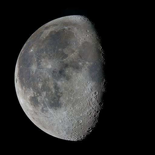
Moon Phase
Waning gibbous
Sunset
08:24 PM
Hourly Forecast
Sun, 09:00 PM
ClearWinds: 8 mph N
91°
Sun, 10:00 PM
ClearWinds: 8 mph N
88°
Sun, 11:00 PM
ClearWinds: 8 mph N
85°
Mon, 12:00 AM
ClearWinds: 8 mph N
82°
Mon, 01:00 AM
ClearWinds: 9 mph N
81°
Mon, 02:00 AM
ClearWinds: 9 mph N
79°
Mon, 03:00 AM
ClearWinds: 10 mph N
77°
Mon, 04:00 AM
ClearWinds: 10 mph N
77°
Mon, 05:00 AM
ClearWinds: 10 mph N
77°
Mon, 06:00 AM
SunnyWinds: 10 mph N
75°
Mon, 07:00 AM
Patchy SmokeWinds: 12 mph N
74°
Mon, 08:00 AM
Areas Of SmokeWinds: 10 mph N
75°
Mon, 09:00 AM
Areas Of SmokeWinds: 15 mph N
78°
Mon, 10:00 AM
Areas Of SmokeWinds: 14 mph N
84°
Mon, 11:00 AM
Areas Of SmokeWinds: 13 mph NNE
89°
Mon, 12:00 PM
Areas Of SmokeWinds: 10 mph NNE
93°
Mon, 01:00 PM
Areas Of SmokeWinds: 7 mph NNE
97°
Mon, 02:00 PM
Patchy SmokeWinds: 3 mph N
102°
Mon, 03:00 PM
Patchy SmokeWinds: 2 mph N
104°
Mon, 04:00 PM
Patchy SmokeWinds: 3 mph NW
104°
Mon, 05:00 PM
Patchy SmokeWinds: 2 mph W
104°
Mon, 06:00 PM
Patchy SmokeWinds: 2 mph W
103°
Mon, 07:00 PM
Mostly ClearWinds: 2 mph W
101°
Mon, 08:00 PM
Mostly ClearWinds: 2 mph NNW
98°
Winds: 10 mph N
Clear. Low around 73, with temperatures rising to around 77 overnight. North wind around 10 mph, with gusts as high as 25 mph.
Winds: 2 to 15 mph NNW
Areas of smoke after 7am. Sunny, with a high near 104. North northwest wind 2 to 15 mph, with gusts as high as 26 mph.
Winds: 2 to 6 mph NW
Patchy smoke. Mostly clear. Low around 73, with temperatures rising to around 77 overnight. Northwest wind 2 to 6 mph.
Winds: 6 mph NE
Sunny, with a high near 104. Northeast wind around 6 mph.
Winds: 1 to 6 mph N
Clear, with a low around 70. North wind 1 to 6 mph.
Winds: 6 mph S
Sunny, with a high near 101.
Winds: 0 to 6 mph N
Clear, with a low around 69.
Winds: 2 to 6 mph W
Sunny, with a high near 102.
Winds: 1 to 6 mph SSW
Clear, with a low around 69.
Winds: 5 mph W
Sunny, with a high near 103.
Winds: 5 mph W
Mostly clear, with a low around 71.
Winds: 2 to 6 mph SE
Sunny, with a high near 102.
Winds: 6 mph W
Clear, with a low around 70.
Winds: 2 to 7 mph W
Sunny, with a high near 99.
Coastal Waters Forecast for Northwest California
National Weather Service Eureka CA
FOR NORTHERN CALIFORNIA WATERS.Northerly winds remain elevated through tonight across much of the area, although the stronger winds are expected to move farther off the Mendocino coast. Monday, the stronger winds continue to push further away from shore. Most of the gales are expected to move out of the waters by early Tuesday. The large steep seas may take additional time to diminish. Lighter winds are expected Wednesday and Thursday.
WATERS FROM PT ST GEORGE TO PT ARENA AND OUT 60 NM
GALE WARNING IN EFFECT UNTIL 3 AM PDT MONDAY
GALE WARNING IN EFFECT THROUGH LATE MONDAY NIGHT
GALE WARNING IN EFFECT UNTIL 9 PM PDT THIS EVENING
HAZARDOUS SEAS WARNING IN EFFECT THROUGH MONDAY MORNING
GALE WARNING IN EFFECT THROUGH LATE MONDAY NIGHT
Oilrig
NWS
Buoy
Fixed Station
USGS
Ship
Other
Search Results
