Millard Tydings Memorial Park, 908 S Washington St, Havre De Grace,
MD
07/13/2025 04:00 AM
73°F
TEMPERATURE
Winds 3 mph SE
Mostly Cloudy
Mostly cloudy, with a low around 72. Southeast wind around 3 mph.
Moonrise
11:38 PM
Moonset
09:34 AM
Sunrise
05:47 AM
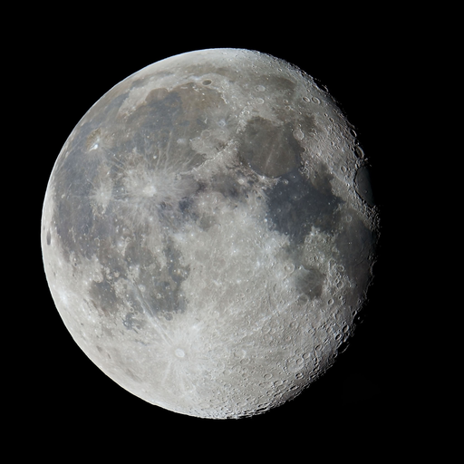
Moon Phase
Waning gibbous
Sunset
08:32 PM
Hourly Forecast
Sun, 04:00 AM
Mostly CloudyWinds: 3 mph SE
73°
Sun, 05:00 AM
Mostly CloudyWinds: 3 mph SE
72°
Sun, 06:00 AM
Mostly CloudyWinds: 3 mph SE
72°
Sun, 07:00 AM
Mostly CloudyWinds: 3 mph SE
73°
Sun, 08:00 AM
Slight Chance Showers And ThunderstormsWinds: 5 mph E
75°
Sun, 09:00 AM
Slight Chance Showers And ThunderstormsWinds: 3 mph SE
76°
Sun, 10:00 AM
Mostly CloudyWinds: 5 mph SE
77°
Sun, 11:00 AM
Mostly CloudyWinds: 5 mph SE
79°
Sun, 12:00 PM
Partly SunnyWinds: 5 mph SE
80°
Sun, 01:00 PM
Slight Chance Showers And ThunderstormsWinds: 5 mph SE
82°
Sun, 02:00 PM
Chance Showers And ThunderstormsWinds: 6 mph SE
83°
Sun, 03:00 PM
Chance Showers And ThunderstormsWinds: 6 mph SE
85°
Sun, 04:00 PM
Chance Showers And ThunderstormsWinds: 6 mph SE
85°
Sun, 05:00 PM
Chance Showers And ThunderstormsWinds: 6 mph SE
85°
Sun, 06:00 PM
Chance Showers And ThunderstormsWinds: 6 mph SE
84°
Sun, 07:00 PM
Chance Showers And ThunderstormsWinds: 5 mph SE
83°
Sun, 08:00 PM
Chance Showers And ThunderstormsWinds: 5 mph SE
80°
Sun, 09:00 PM
Chance Showers And ThunderstormsWinds: 5 mph SE
77°
Sun, 10:00 PM
Chance Showers And ThunderstormsWinds: 3 mph SE
76°
Sun, 11:00 PM
Chance Showers And ThunderstormsWinds: 3 mph SE
75°
Mon, 12:00 AM
Chance Showers And ThunderstormsWinds: 3 mph SE
74°
Mon, 01:00 AM
Chance Showers And ThunderstormsWinds: 2 mph SE
74°
Mon, 02:00 AM
Chance Showers And ThunderstormsWinds: 2 mph SE
73°
Mon, 03:00 AM
Chance Showers And ThunderstormsWinds: 2 mph SE
73°
Winds: 3 mph SE
Mostly cloudy, with a low around 72. Southeast wind around 3 mph.
Winds: 6 mph SE
A chance of showers and thunderstorms after 8am. Partly sunny, with a high near 87. Southeast wind around 6 mph. Chance of precipitation is 40%.
Winds: 2 to 6 mph SE
A chance of showers and thunderstorms before 2am, then a chance of showers and thunderstorms. Mostly cloudy, with a low around 72. Southeast wind 2 to 6 mph. Chance of precipitation is 50%. New rainfall amounts between a tenth and quarter of an inch possible.
Winds: 5 mph SE
A chance of showers and thunderstorms before 11am, then a chance of showers and thunderstorms between 11am and 2pm, then showers and thunderstorms. Mostly cloudy, with a high near 87. Southeast wind around 5 mph. Chance of precipitation is 80%. New rainfall amounts between a quarter and half of an inch possible.
Winds: 3 mph S
Showers and thunderstorms before 8pm, then a chance of showers and thunderstorms between 8pm and 2am, then a chance of showers and thunderstorms. Mostly cloudy, with a low around 73. South wind around 3 mph. Chance of precipitation is 80%.
Winds: 3 mph SE
Showers and thunderstorms likely. Mostly cloudy, with a high near 87. Chance of precipitation is 60%.
Winds: 3 mph S
Showers and thunderstorms likely. Mostly cloudy, with a low around 73. Chance of precipitation is 60%.
Winds: 2 to 7 mph S
A slight chance of rain showers before 8am, then showers and thunderstorms likely. Partly sunny, with a high near 89. Chance of precipitation is 60%.
Winds: 7 mph S
Showers and thunderstorms likely before 8pm, then a chance of showers and thunderstorms. Mostly cloudy, with a low around 74. Chance of precipitation is 60%.
Winds: 5 to 8 mph SW
A slight chance of showers and thunderstorms before 2pm, then showers and thunderstorms likely. Partly sunny, with a high near 91. Chance of precipitation is 60%.
Winds: 3 to 7 mph SW
Showers and thunderstorms likely before 8pm, then a chance of showers and thunderstorms between 8pm and 2am. Mostly cloudy, with a low around 74. Chance of precipitation is 60%.
Winds: 3 to 7 mph W
A chance of showers and thunderstorms after 2pm. Mostly sunny, with a high near 90. Chance of precipitation is 40%.
Winds: 5 mph NW
A chance of showers and thunderstorms. Partly cloudy, with a low around 72. Chance of precipitation is 40%.
Winds: 6 mph NW
A slight chance of rain showers before 2pm, then a chance of showers and thunderstorms. Mostly sunny, with a high near 88.
Coastal Waters Forecast for New Jersey and Delaware
National Weather Service Mount Holly NJ
FOR THE COASTAL WATERS FROM SANDY HOOK NJ TO FENWICK ISLAND DE AND FOR DELAWARE BAY. An extended period of very warm, humid, and unsettled weather conditions is expected for the upcoming week. A cold front approaches the region today into Monday before slowly crossing through later Monday into Tuesday. Thereafter, the front stalls near/over the region before lifting back north as a warm front later Wednesday into Thursday. Another cold front approaches towards the end of week.
Sandy Hook NJ to Fenwick Island DE to 20 NM offshore and Delaware Bay
TODAY
E winds 5 to 10 kt Seas 2 to 3 ft Wave Detail: SE 3 ft at 7 seconds Patchy fog A chance of drizzle this afternoon Vsby 1 to 3 NM
TONIGHT
SE winds 5 to 10 kt, becoming S after midnight Seas around 2 ft Wave Detail: SE 2 ft at 7 seconds A chance of drizzle Areas of fog Vsby 1 to 3 NM
MON
S winds 5 to 10 kt Seas around 2 ft Wave Detail: SE 2 ft at 6 seconds A chance of showers and tstms in the afternoon with vsby 1 to 3 NM
MON NIGHT
SW winds 5 to 10 kt Seas around 2 ft Wave Detail: SE 2 ft at 6 seconds A chance of showers and tstms Vsby 1 to 3 NM in the evening
TUE
SW winds around 5 kt, becoming S in the afternoon Seas around 2 ft Wave Detail: SE 2 ft at 6 seconds A chance of showers and tstms
TUE NIGHT
SW winds 5 to 10 kt Seas around 2 ft Wave Detail: SE 2 ft at 6 seconds A chance of showers and tstms in the evening
WED
S winds 5 to 10 kt Seas 2 to 3 ft A chance of showers
WED NIGHT
SW winds 5 to 10 kt Seas 2 to 3 ft A chance of showers
THU
SW winds 5 to 10 kt Seas 2 to 4 ft A chance of showers A chance of tstms in the afternoon
THU NIGHT
SW winds 5 to 10 kt Seas 3 to 4 ft A chance of tstms in the evening A chance of showers
TODAY
E winds 5 to 10 kt Seas 2 to 3 ft Wave Detail: SE 2 ft at 7 seconds Patchy fog A chance of drizzle this afternoon Vsby 1 to 3 NM
TONIGHT
SE winds 5 to 10 kt, becoming S after midnight Seas around 2 ft Wave Detail: SE 2 ft at 7 seconds A chance of drizzle Areas of fog Vsby 1 to 3 NM
MON
S winds 5 to 10 kt Seas around 2 ft Wave Detail: SE 2 ft at 6 seconds A chance of showers and tstms in the afternoon
MON NIGHT
S winds 5 to 10 kt Seas around 2 ft Wave Detail: E 2 ft at 7 seconds and S 1 foot at 4 seconds A chance of showers and tstms Vsby 1 to 3 NM in the evening
TUE
SW winds 5 to 10 kt Seas around 2 ft Wave Detail: SE 2 ft at 7 seconds A chance of showers and tstms
TUE NIGHT
SW winds 5 to 10 kt Seas around 2 ft Wave Detail: SE 2 ft at 6 seconds A chance of tstms in the evening A chance of showers
WED
SW winds 5 to 10 kt, becoming S 10 to 15 kt in the afternoon Seas 2 to 3 ft A chance of showers
WED NIGHT
SW winds 10 to 15 kt Seas around 3 ft A chance of showers
THU
SW winds 10 to 15 kt Seas 3 to 4 ft A chance of showers A chance of tstms in the afternoon
THU NIGHT
SW winds 10 to 15 kt Seas 3 to 4 ft A chance of tstms in the evening A chance of showers
TODAY
E winds 5 to 10 kt Seas 2 to 3 ft Wave Detail: SE 2 ft at 7 seconds Patchy fog Vsby 1 to 3 NM
TONIGHT
SE winds around 5 kt Seas around 2 ft Wave Detail: SE 2 ft at 7 seconds A chance of drizzle Areas of fog Vsby 1 to 3 NM
MON
S winds 5 to 10 kt Seas around 2 ft Wave Detail: SE 2 ft at 6 seconds Patchy fog in the morning Vsby 1 to 3 NM
MON NIGHT
S winds 5 to 10 kt Seas around 2 ft Wave Detail: E 2 ft at 7 seconds and S 1 foot at 4 seconds A chance of showers and tstms after midnight
TUE
SW winds 5 to 10 kt Seas around 2 ft Wave Detail: SE 2 ft at 6 seconds A chance of showers and tstms
TUE NIGHT
SW winds 5 to 10 kt Seas around 2 ft Wave Detail: SE 2 ft at 6 seconds A chance of tstms in the evening A chance of showers
WED
SW winds 5 to 10 kt, becoming S 10 to 15 kt in the afternoon Seas 2 to 3 ft A chance of showers
WED NIGHT
SW winds 10 to 15 kt Seas around 3 ft A chance of showers and tstms after midnight
THU
SW winds 10 to 15 kt Seas 3 to 4 ft A chance of showers and tstms
THU NIGHT
SW winds 10 to 15 kt Seas 3 to 4 ft A chance of showers and tstms
TODAY
E winds 5 to 10 kt Seas around 2 ft Wave Detail: SE 2 ft at 7 seconds Patchy fog early this morning with vsby 1 to 3 NM
TONIGHT
SE winds 5 to 10 kt, becoming S after midnight Seas around 2 ft Wave Detail: SE 2 ft at 6 seconds Patchy fog Vsby 1 to 3 NM
MON
S winds 5 to 10 kt Seas around 2 ft Wave Detail: SE 2 ft at 6 seconds A chance of tstms in the afternoon
MON NIGHT
S winds 5 to 10 kt Seas around 2 ft Wave Detail: E 2 ft at 7 seconds and S 1 foot at 3 seconds A chance of showers and tstms after midnight
TUE
SW winds 5 to 10 kt Seas around 2 ft Wave Detail: SE 2 ft at 6 seconds A chance of showers and tstms
TUE NIGHT
SW winds 5 to 10 kt Seas around 2 ft Wave Detail: SE 2 ft at 6 seconds A chance of showers and tstms
WED
SW winds 5 to 10 kt, becoming S 10 to 15 kt in the afternoon Seas 2 to 3 ft A chance of tstms in the morning A chance of showers
WED NIGHT
SW winds 10 to 15 kt Seas 2 to 3 ft A chance of showers and tstms after midnight
THU
SW winds 10 to 15 kt Seas 3 to 4 ft A chance of showers and tstms
THU NIGHT
SW winds 10 to 15 kt Seas 2 to 4 ft A chance of showers and tstms
TODAY
E winds 5 to 10 kt Seas around 2 ft Wave Detail: SE 2 ft at 7 seconds Patchy fog early this morning with vsby 1 to 3 NM
TONIGHT
SE winds 5 to 10 kt, becoming S after midnight Seas around 2 ft Wave Detail: SE 2 ft at 6 seconds Patchy fog Vsby 1 to 3 NM
MON
S winds 5 to 10 kt Seas around 2 ft Wave Detail: SE 2 ft at 6 seconds A chance of showers and tstms in the afternoon
MON NIGHT
S winds 5 to 10 kt Seas around 2 ft Wave Detail: E 2 ft at 7 seconds and S 1 foot at 3 seconds A chance of showers and tstms Vsby 1 to 3 NM in the evening
TUE
SW winds 5 to 10 kt Seas around 2 ft Wave Detail: SE 2 ft at 6 seconds A chance of showers and tstms
TUE NIGHT
S winds 5 to 10 kt Seas around 2 ft Wave Detail: SE 2 ft at 6 seconds A chance of showers and tstms
WED
SW winds 5 to 10 kt, becoming S 10 to 15 kt in the afternoon Seas 2 to 3 ft A chance of tstms in the morning A chance of showers
WED NIGHT
SW winds 10 to 15 kt Seas 2 to 3 ft A chance of showers and tstms after midnight
THU
SW winds 10 to 15 kt Seas 2 to 4 ft A chance of showers and tstms
THU NIGHT
SW winds 10 to 15 kt Seas 2 to 4 ft A chance of showers and tstms
TODAY
E winds 5 to 10 kt Seas around 2 ft Wave Detail: SE 2 ft at 7 seconds Patchy fog early this morning with vsby 1 to 3 NM
TONIGHT
SE winds around 10 kt, becoming S after midnight Seas around 2 ft Wave Detail: SE 2 ft at 6 seconds Patchy fog after midnight with vsby 1 to 3 NM
MON
S winds 5 to 10 kt Seas around 2 ft Wave Detail: SE 1 foot at 6 seconds A chance of showers and tstms in the afternoon
MON NIGHT
S winds 5 to 10 kt Seas around 2 ft Wave Detail: SE 2 ft at 6 seconds A chance of showers and tstms Vsby 1 to 3 NM in the evening
TUE
SW winds 5 to 10 kt Seas around 2 ft Wave Detail: SE 2 ft at 6 seconds A chance of showers and tstms
TUE NIGHT
S winds 5 to 10 kt Seas 2 to 3 ft Wave Detail: SE 2 ft at 6 seconds A chance of showers and tstms
WED
SW winds 5 to 10 kt, becoming S 10 to 15 kt in the afternoon Seas 2 to 3 ft A chance of showers and tstms
WED NIGHT
SW winds 10 to 15 kt Seas 2 to 3 ft A chance of showers and tstms
THU
SW winds 10 to 15 kt Seas around 3 ft A chance of showers and tstms
THU NIGHT
SW winds 10 to 15 kt Seas 2 to 3 ft A chance of showers and tstms
TODAY
E winds around 5 kt, becoming SE late Seas 1 foot or less Wave Detail: S 1 foot at 5 seconds A chance of drizzle early this morning Areas of fog early this morning, then patchy fog late this morning Vsby 1 to 3 NM this morning
TONIGHT
SE winds 5 to 10 kt Seas 1 foot or less Wave Detail: SE 1 foot at 3 seconds Patchy fog Vsby 1 to 3 NM
MON
S winds 5 to 10 kt Seas 1 foot or less Patchy fog in the morning A chance of showers in the morning, then a chance of showers and tstms in the afternoon Vsby 1 to 3 NM
MON NIGHT
S winds 5 to 10 kt Seas 1 foot or less Wave Detail: S 1 foot at 3 seconds A chance of showers and tstms Vsby 1 to 3 NM in the evening
TUE
S winds 5 to 10 kt Seas 1 foot or less Wave Detail: S 1 foot at 5 seconds A chance of showers and tstms
TUE NIGHT
S winds 5 to 10 kt Seas 1 foot or less Wave Detail: S 1 foot at 4 seconds A chance of tstms A chance of showers after midnight
WED
S winds 5 to 10 kt Seas 1 foot or less, then around 2 ft in the afternoon A chance of showers and tstms
WED NIGHT
S winds around 10 kt Seas around 2 ft A chance of showers and tstms
THU
SW winds around 10 kt Seas around 2 ft A chance of showers and tstms
THU NIGHT
SW winds around 10 kt Seas around 2 ft A chance of showers and tstms
TODAY
E winds around 5 kt, becoming SE late Seas 1 foot or less Patchy fog this morning with vsby 1 to 3 NM
TONIGHT
SE winds 5 to 10 kt Seas 1 foot or less Wave Detail: SE 1 foot at 3 seconds Patchy fog after midnight with vsby 1 to 3 NM
MON
SE winds 5 to 10 kt Seas 1 foot or less Patchy fog in the morning A chance of showers in the morning, then showers and tstms likely in the afternoon Vsby 1 to 3 NM
MON NIGHT
S winds 5 to 10 kt, becoming SW after midnight Seas 1 foot or less Wave Detail: SE 1 foot at 3 seconds Showers and tstms likely, mainly in the evening with vsby 1 to 3 NM
TUE
S winds around 5 kt Seas 1 foot or less A chance of tstms A chance of showers in the morning, then showers likely in the afternoon
TUE NIGHT
S winds around 5 kt Seas 1 foot or less Wave Detail: SE 1 foot at 3 seconds Showers likely with a chance of tstms in the evening, then a chance of showers after midnight
WED
S winds 5 to 10 kt Seas 1 foot or less A chance of showers A chance of tstms in the afternoon
WED NIGHT
S winds 5 to 10 kt Seas 1 foot or less A chance of showers and tstms
THU
SW winds around 10 kt Seas 1 foot or less A chance of showers A chance of tstms in the afternoon
THU NIGHT
SW winds 5 to 10 kt Seas 1 foot or less A chance of showers and tstms
Oilrig
NWS
Buoy
Fixed Station
USGS
Ship
Other


Search Results
