Millard Tydings Memorial Park%2C 908 S Washington St%2C Havre De Grace,
MD
04/26/2024 02:00 PM
62°F
TEMPERATURE
Winds 8 mph SE
Sunny
Weather will be Clear.Maximum Temperatures 62 F. Minimum Temperatures 39 F. Windspeed 13.4 SE.
Moonrise
12:11 AM
Moonset
08:26 AM
Sunrise
06:10 AM
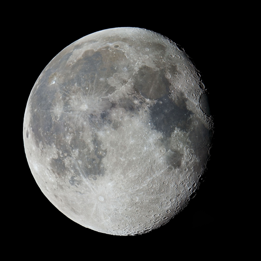
Moon Phase
Waning gibbous
Sunset
07:53 PM
Hourly Forecast
Fri, 02:00 PM
SunnyWinds: 8 mph SE
62°
Fri, 03:00 PM
SunnyWinds: 8 mph SE
63°
Fri, 04:00 PM
SunnyWinds: 9 mph SE
63°
Fri, 05:00 PM
SunnyWinds: 9 mph SE
62°
Fri, 06:00 PM
Mostly ClearWinds: 10 mph SE
59°
Fri, 07:00 PM
Mostly ClearWinds: 10 mph SE
55°
Fri, 08:00 PM
Mostly ClearWinds: 9 mph SE
50°
Fri, 09:00 PM
Mostly ClearWinds: 9 mph SE
48°
Fri, 10:00 PM
Partly CloudyWinds: 8 mph SE
45°
Fri, 11:00 PM
Partly CloudyWinds: 7 mph SE
43°
Sat, 12:00 AM
Partly CloudyWinds: 7 mph S
42°
Sat, 01:00 AM
Partly CloudyWinds: 6 mph S
42°
Sat, 02:00 AM
Partly CloudyWinds: 6 mph S
40°
Sat, 03:00 AM
Partly CloudyWinds: 6 mph SE
40°
Sat, 04:00 AM
Mostly CloudyWinds: 5 mph SE
40°
Sat, 05:00 AM
Mostly CloudyWinds: 5 mph SE
39°
Sat, 06:00 AM
Partly SunnyWinds: 5 mph SE
40°
Sat, 07:00 AM
Mostly CloudyWinds: 5 mph SE
40°
Sat, 08:00 AM
Mostly CloudyWinds: 6 mph SE
45°
Sat, 09:00 AM
Mostly CloudyWinds: 7 mph SE
49°
Sat, 10:00 AM
CloudyWinds: 7 mph SE
52°
Sat, 11:00 AM
CloudyWinds: 8 mph S
55°
Sat, 12:00 PM
CloudyWinds: 9 mph S
57°
Sat, 01:00 PM
Isolated Rain ShowersWinds: 9 mph S
58°
Winds: 13.4 mph SE
Weather will be Clear.Maximum Temperatures 62 F. Minimum Temperatures 39 F. Windspeed 13.4 SE.
Winds: 13.3 mph SSE
Weather will be Mostly Cloudy.Maximum Temperatures 61 F. Minimum Temperatures 41 F. Windspeed 13.3 SSE.
Winds: 11.01 mph SSW
Weather will be Partly Cloudy.Maximum Temperatures 76 F. Minimum Temperatures 50 F. Windspeed 11.01 SSW.
Winds: 6.5 mph SW
Weather will be Mostly Clear.Maximum Temperatures 83 F. Minimum Temperatures 59 F. Windspeed 6.5 SW.
Winds: 12.9 mph SW
Weather will be Partly Cloudy.Maximum Temperatures 80 F. Minimum Temperatures 61 F. Windspeed 12.9 SW.
Winds: 8.64 mph NW
Weather will be Mostly Clear.Maximum Temperatures 78 F. Minimum Temperatures 60 F. Windspeed 8.64 NW.
Winds: 14.71 mph SSW
Weather will be Mostly Clear.Maximum Temperatures 76 F. Minimum Temperatures 57 F. Windspeed 14.71 SSW.
Winds: 14.13 mph SW
Weather will be Mostly Cloudy.Maximum Temperatures 79 F. Minimum Temperatures 62 F. Windspeed 14.13 SW.
Winds: 14.1 mph NW
Weather will be Mostly Cloudy.Maximum Temperatures 68 F. Minimum Temperatures 56 F. Windspeed 14.1 NW.
Winds: 14.95 mph NW
Weather will be Mostly Clear.Maximum Temperatures 65 F. Minimum Temperatures 44 F. Windspeed 14.95 NW.
Coastal Waters Forecast for New Jersey
National Weather Service Mount Holly NJ
FOR THE COASTAL WATERS FROM SANDY HOOK NJ TO FENWICK ISLAND DE AND FOR DELAWARE BAY. High pressure builds in early this morning and lingers through the remainder of the day, before a series of fronts and low pressure systems affect the East Coast Wednesday through the end of the week. High pressure looks to return to end the weekend and start the new week.
New Jersey and Delaware Coastal Waters and Delaware Bay
THIS AFTERNOON
SE winds 5 to 10 kt Seas around 2 ft Wave Detail: E 2 ft at 7 seconds
TONIGHT
S winds 5 to 10 kt Seas 2 to 3 ft Wave Detail: E 2 ft at 7 seconds
SAT
S winds 5 to 10 kt, increasing to 10 to 15 kt with gusts up to 20 kt in the afternoon Seas 2 to 3 ft Wave Detail: SE 3 ft at 7 seconds and SE 2 ft at 3 seconds
SAT NIGHT
S winds 10 to 15 kt with gusts up to 20 kt Seas 2 to 3 ft Wave Detail: SE 3 ft at 7 seconds and S 2 ft at 4 seconds
SUN
S winds around 10 kt Seas 2 to 3 ft Wave Detail: SE 3 ft at 8 seconds and S 2 ft at 4 seconds
SUN NIGHT
SW winds 5 to 10 kt, becoming W after midnight Seas 2 to 3 ft Wave Detail: S 2 ft at 5 seconds and E 2 ft at 9 seconds
MON
NW winds 5 to 10 kt, becoming E in the afternoon Seas 2 to 3 ft
MON NIGHT
SE winds around 10 kt Seas 2 to 3 ft in the evening
TUE
SE winds 10 to 15 kt
TUE NIGHT
SE winds 10 to 15 kt, becoming NW after midnight A chance of showers
THIS AFTERNOON
E winds around 10 kt Seas 2 to 3 ft Wave Detail: E 3 ft at 7 seconds
TONIGHT
SE winds 5 to 10 kt Seas 2 to 3 ft Wave Detail: E 3 ft at 7 seconds
SAT
SE winds 5 to 10 kt Seas 2 to 3 ft Wave Detail: E 3 ft at 7 seconds
SAT NIGHT
S winds 10 to 15 kt Seas around 3 ft Wave Detail: SE 3 ft at 7 seconds and S 1 ft at 3 seconds
SUN
S winds 10 to 15 kt with gusts up to 20 kt Seas 3 to 4 ft Wave Detail: S 3 ft at 4 seconds and SE 3 ft at 8 seconds
SUN NIGHT
SW winds 10 to 15 kt with gusts up to 20 kt, becoming W 5 to 10 kt after midnight Seas 3 to 4 ft Wave Detail: S 3 ft at 5 seconds and E 2 ft at 9 seconds
MON
NW winds 5 to 10 kt, becoming E in the afternoon Seas 2 to 3 ft
MON NIGHT
S winds around 10 kt Seas around 3 ft in the evening
TUE
SE winds 10 to 15 kt
TUE NIGHT
S winds 10 to 15 kt, becoming W after midnight
THIS AFTERNOON
E winds 10 to 15 kt Seas around 3 ft Wave Detail: E 3 ft at 8 seconds and E 1 ft at 3 seconds
TONIGHT
SE winds 5 to 10 kt Seas around 3 ft Wave Detail: E 3 ft at 7 seconds
SAT
SE winds 5 to 10 kt Seas around 3 ft Wave Detail: E 3 ft at 7 seconds
SAT NIGHT
S winds around 10 kt Seas around 3 ft Wave Detail: SE 3 ft at 7 seconds
SUN
S winds 10 to 15 kt with gusts up to 20 kt Seas 3 to 4 ft Wave Detail: SE 3 ft at 8 seconds and S 2 ft at 4 seconds
SUN NIGHT
SW winds 10 to 15 kt with gusts up to 20 kt, becoming W 5 to 10 kt after midnight Seas 3 to 4 ft Wave Detail: SE 3 ft at 8 seconds and S 2 ft at 5 seconds
MON
NW winds 5 to 10 kt, becoming E in the afternoon Seas 2 to 3 ft
MON NIGHT
S winds around 10 kt Seas around 3 ft in the evening
TUE
S winds 10 to 15 kt
TUE NIGHT
S winds 10 to 15 kt, becoming SW after midnight
THIS AFTERNOON
E winds 10 to 15 kt Seas 3 to 4 ft Wave Detail: E 4 ft at 8 seconds
TONIGHT
E winds 10 to 15 kt, becoming SE 5 to 10 kt after midnight Seas around 3 ft Wave Detail: E 3 ft at 7 seconds
SAT
SE winds 5 to 10 kt Seas around 3 ft Wave Detail: E 3 ft at 7 seconds
SAT NIGHT
S winds 5 to 10 kt Seas around 3 ft Wave Detail: SE 3 ft at 7 seconds
SUN
S winds around 10 kt Seas 3 to 4 ft Wave Detail: SE 3 ft at 7 seconds
SUN NIGHT
SW winds 5 to 10 kt Seas 3 to 4 ft Wave Detail: SE 3 ft at 9 seconds and S 2 ft at 5 seconds
MON
NW winds 5 to 10 kt, becoming SE in the afternoon Seas 2 to 3 ft
MON NIGHT
S winds around 10 kt Seas around 3 ft in the evening
TUE
S winds 10 to 15 kt
TUE NIGHT
S winds 10 to 15 kt, becoming SW after midnight
THIS AFTERNOON
E winds 10 to 15 kt Seas 3 to 4 ft Wave Detail: E 4 ft at 8 seconds
TONIGHT
SE winds 10 to 15 kt Seas around 3 ft Wave Detail: E 3 ft at 7 seconds
SAT
SE winds 10 to 15 kt Seas 3 to 4 ft Wave Detail: E 3 ft at 7 seconds
SAT NIGHT
S winds 5 to 10 kt Seas around 3 ft Wave Detail: SE 3 ft at 8 seconds
SUN
S winds around 10 kt Seas 3 to 4 ft Wave Detail: SE 3 ft at 8 seconds and S 2 ft at 4 seconds
SUN NIGHT
SW winds 5 to 10 kt Seas 3 to 4 ft Wave Detail: E 3 ft at 8 seconds and S 2 ft at 5 seconds
MON
NW winds 5 to 10 kt, becoming S in the afternoon Seas 2 to 3 ft
MON NIGHT
S winds around 10 kt Seas 2 to 3 ft in the evening
TUE
S winds 10 to 15 kt
TUE NIGHT
S winds 10 to 15 kt, becoming SW after midnight
THIS AFTERNOON
E winds 10 to 15 kt Seas 3 to 4 ft Wave Detail: E 4 ft at 8 seconds
TONIGHT
E winds 10 to 15 kt Seas 3 to 4 ft Wave Detail: E 4 ft at 8 seconds and E 2 ft at 5 seconds
SAT
SE winds around 10 kt Seas 3 to 4 ft Wave Detail: E 3 ft at 7 seconds
SAT NIGHT
S winds 5 to 10 kt Seas 3 to 4 ft Wave Detail: E 3 ft at 8 seconds
SUN
S winds around 10 kt with gusts up to 20 kt Seas 3 to 4 ft Wave Detail: E 3 ft at 8 seconds and S 2 ft at 4 seconds
SUN NIGHT
SW winds 5 to 10 kt Seas 3 to 4 ft Wave Detail: E 3 ft at 8 seconds and S 2 ft at 5 seconds
MON
NW winds 5 to 10 kt, becoming SE in the afternoon Seas 2 to 3 ft
MON NIGHT
S winds around 10 kt Seas 2 to 3 ft in the evening
TUE
S winds 10 to 15 kt
TUE NIGHT
SW winds 10 to 15 kt
THIS AFTERNOON
E winds 10 to 15 kt Waves around 2 ft
TONIGHT
SE winds 10 to 15 kt Waves around 2 ft
SAT
SE winds 10 to 15 kt Waves around 2 ft
SAT NIGHT
S winds 10 to 15 kt Waves around 2 ft
SUN
S winds 5 to 10 kt Waves around 2 ft
SUN NIGHT
SW winds 5 to 10 kt Waves around 2 ft
MON
NW winds 5 to 10 kt, becoming S in the afternoon Waves around 2 ft
MON NIGHT
S winds 5 to 10 kt Waves around 2 ft in the evening
TUE
S winds 5 to 10 kt
TUE NIGHT
S winds around 10 kt, becoming SW after midnight
THIS AFTERNOON
SE winds 10 to 15 kt Waves around 2 ft
TONIGHT
SE winds 10 to 15 kt, diminishing to 5 to 10 kt after midnight Waves around 2 ft
SAT
SE winds 5 to 10 kt, increasing to 10 to 15 kt with gusts up to 20 kt in the afternoon Waves around 2 ft
SAT NIGHT
S winds 10 to 15 kt Waves around 2 ft
SUN
SW winds 5 to 10 kt Waves 1 foot or less
SUN NIGHT
SW winds 5 to 10 kt Waves 1 foot or less
MON
NW winds 5 to 10 kt, becoming SW in the afternoon Waves 1 foot or less
MON NIGHT
S winds 5 to 10 kt Waves 1 foot or less in the evening
TUE
S winds 5 to 10 kt
TUE NIGHT
SW winds around 10 kt, becoming W after midnight A chance of showers and tstms
Oilrig
NWS
Buoy
Fixed Station
USGS
Ship
Other


Search Results
