Annapolis,
MD
07/12/2025 12:00 AM
78°F
TEMPERATURE
Winds 2 mph SE
Mostly Clear
Mostly clear, with a low around 74. Southeast wind around 2 mph.
Moonrise
10:35 PM
Moonset
07:14 AM
Sunrise
05:50 AM
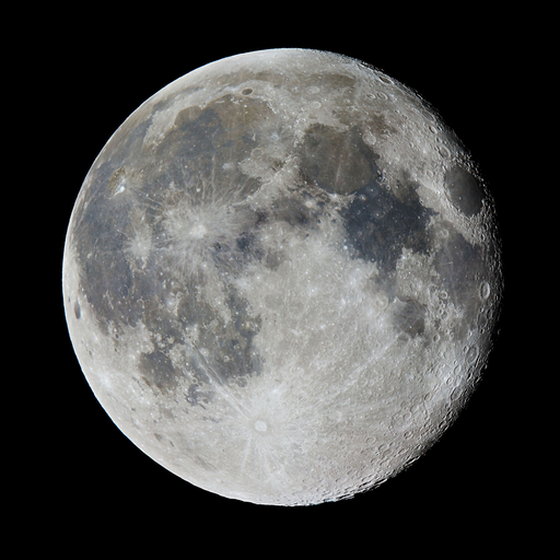
Moon Phase
Waning gibbous
Sunset
08:33 PM
Hourly Forecast
Sat, 12:00 AM
Mostly ClearWinds: 2 mph SE
78°
Sat, 01:00 AM
Mostly ClearWinds: 2 mph SE
77°
Sat, 02:00 AM
Mostly ClearWinds: 2 mph SE
77°
Sat, 03:00 AM
Mostly ClearWinds: 2 mph SE
76°
Sat, 04:00 AM
Partly CloudyWinds: 2 mph SE
76°
Sat, 05:00 AM
Partly CloudyWinds: 2 mph SE
75°
Sat, 06:00 AM
Mostly SunnyWinds: 2 mph SE
75°
Sat, 07:00 AM
Mostly SunnyWinds: 2 mph E
76°
Sat, 08:00 AM
Mostly SunnyWinds: 2 mph E
78°
Sat, 09:00 AM
Mostly SunnyWinds: 2 mph E
80°
Sat, 10:00 AM
SunnyWinds: 2 mph E
82°
Sat, 11:00 AM
SunnyWinds: 3 mph E
83°
Sat, 12:00 PM
SunnyWinds: 5 mph E
85°
Sat, 01:00 PM
SunnyWinds: 5 mph E
86°
Sat, 02:00 PM
Slight Chance Showers And ThunderstormsWinds: 6 mph SE
87°
Sat, 03:00 PM
Slight Chance Showers And ThunderstormsWinds: 6 mph SE
88°
Sat, 04:00 PM
Slight Chance Showers And ThunderstormsWinds: 6 mph SE
88°
Sat, 05:00 PM
Chance Showers And ThunderstormsWinds: 6 mph SE
87°
Sat, 06:00 PM
Slight Chance Showers And ThunderstormsWinds: 6 mph SE
87°
Sat, 07:00 PM
Slight Chance Showers And ThunderstormsWinds: 6 mph SE
85°
Sat, 08:00 PM
Partly CloudyWinds: 6 mph SE
84°
Sat, 09:00 PM
Partly CloudyWinds: 6 mph SE
82°
Sat, 10:00 PM
Partly CloudyWinds: 6 mph SE
81°
Sat, 11:00 PM
Partly CloudyWinds: 6 mph SE
80°
Winds: 2 mph SE
Mostly clear, with a low around 74. Southeast wind around 2 mph.
Winds: 2 to 6 mph SE
A chance of showers and thunderstorms after 2pm. Sunny, with a high near 90. Southeast wind 2 to 6 mph. Chance of precipitation is 30%.
Winds: 6 mph SE
A slight chance of showers and thunderstorms before 8pm. Partly cloudy, with a low around 74. Southeast wind around 6 mph. Chance of precipitation is 20%.
Winds: 3 to 7 mph SE
A chance of rain showers between 8am and 2pm, then a chance of showers and thunderstorms. Partly sunny, with a high near 89. Southeast wind 3 to 7 mph. Chance of precipitation is 50%. New rainfall amounts between a tenth and quarter of an inch possible.
Winds: 2 to 7 mph S
A chance of showers and thunderstorms before 8pm, then showers and thunderstorms likely. Mostly cloudy, with a low around 74. South wind 2 to 7 mph. Chance of precipitation is 60%.
Winds: 2 to 6 mph S
A chance of rain showers before 11am, then a chance of showers and thunderstorms between 11am and 2pm, then showers and thunderstorms likely. Mostly cloudy, with a high near 88. Chance of precipitation is 70%.
Winds: 5 mph SW
Showers and thunderstorms likely before 8pm, then a chance of showers and thunderstorms. Mostly cloudy, with a low around 74. Chance of precipitation is 70%.
Winds: 2 to 6 mph E
A chance of showers and thunderstorms. Partly sunny, with a high near 89. Chance of precipitation is 30%.
Winds: 2 to 6 mph S
A chance of showers and thunderstorms before 2am. Partly cloudy, with a low around 74. Chance of precipitation is 30%.
Winds: 2 to 9 mph S
A slight chance of rain showers between 8am and 2pm, then a chance of showers and thunderstorms. Partly sunny, with a high near 89. Chance of precipitation is 40%.
Winds: 6 to 9 mph S
A chance of showers and thunderstorms before 2am. Partly cloudy, with a low around 76. Chance of precipitation is 40%.
Winds: 8 mph S
A slight chance of rain showers between 8am and 2pm, then a chance of showers and thunderstorms. Partly sunny, with a high near 92. Chance of precipitation is 50%.
Winds: 7 mph S
A chance of showers and thunderstorms. Mostly cloudy, with a low around 77. Chance of precipitation is 50%.
Winds: 8 mph SW
A chance of rain showers before 2pm, then a chance of showers and thunderstorms. Partly sunny, with a high near 90.
Coastal Waters Forecast
National Weather Service Baltimore MD/Washington DC
FOR THE TIDAL POTOMAC AND MD PORTION OF THE CHESAPEAKE BAY.
Tidal Potomac River and Maryland portion of Chesapeake Bay. Forecasts of wave heights do not include effects of wind direction relative to tidal currents. Expect higher waves when winds are blowing against the tidal flow. Waves flat where waters are iced over. A weak front will remain stalled just north of the waters through today before dissipating. A second front may settle southward into the area over the weekend. A stronger cold front approaches from the west early next week.
REST OF TONIGHT
Light winds Waves flat
SAT
SE winds around 5 kt Waves 1 ft or less A chance of showers and tstms
SAT NIGHT
SE winds around 5 kt Waves 1 ft
SUN
SE winds around 5 kt Waves 1 ft Showers likely with a chance of tstms
SUN NIGHT
S winds around 5 kt Waves 1 ft or less A chance of showers and tstms
MON
SW winds around 5 kt Waves 1 ft Showers and tstms likely
MON NIGHT
S winds around 5 kt Waves 1 ft or less
TUE
S winds around 5 kt Waves 1 ft or less A chance of showers and tstms through the night
WED
S winds around 5 kt Waves 1 ft A chance of showers and tstms through the night
REST OF TONIGHT
Light winds Waves flat
SAT
SE winds around 5 kt Waves 1 ft or less
SAT NIGHT
SE winds around 5 kt Waves 1 ft
SUN
SE winds around 5 kt Waves 1 ft A chance of tstms
SUN NIGHT
S winds around 5 kt Waves 1 ft A chance of showers and tstms
MON
S winds around 5 kt Waves 1 ft or less Showers and tstms likely
MON NIGHT
SW winds around 5 kt Waves 1 ft or less A chance of tstms
TUE
S winds around 5 kt Waves 1 ft or less A chance of showers and tstms through the night
WED
S winds around 5 kt Waves 1 ft A chance of showers and tstms through the night
REST OF TONIGHT
S winds 5 kt Waves flat
SAT
E winds 5 to 10 kt Waves 1 ft or less
SAT NIGHT
SE winds 5 to 10 kt Waves 1 ft
SUN
SE winds 5 to 10 kt Waves 1 ft A chance of showers and tstms
SUN NIGHT
S winds 5 to 10 kt Waves 1 ft A chance of showers and tstms
MON
S winds around 5 kt Waves 1 ft or less Showers and tstms likely
MON NIGHT
SW winds around 5 kt Waves 1 ft or less A chance of showers and tstms
TUE
S winds around 5 kt Waves 1 ft or less A chance of showers A chance of tstms through the night
WED
S winds 5 to 10 kt Waves 1 ft A chance of showers and tstms through the night
REST OF TONIGHT
SE winds 5 kt Waves flat
SAT
E winds around 5 kt Waves flat A chance of showers and tstms
SAT NIGHT
SE winds 5 to 10 kt Waves 1 ft or less
SUN
SE winds 5 kt Waves flat A chance of showers and tstms
SUN NIGHT
SE winds around 5 kt Waves flat A chance of showers and tstms
MON
S winds around 5 kt Waves flat Showers likely with a chance of tstms
MON NIGHT
SW winds around 5 kt Waves flat A chance of showers and tstms
TUE
S winds around 5 kt Waves flat A chance of showers and tstms through the night
WED
S winds 5 to 10 kt Waves 1 ft or less A chance of showers and tstms through the night
REST OF TONIGHT
SE winds 5 kt Waves flat
SAT
SE winds around 5 kt Waves flat A chance of showers and tstms
SAT NIGHT
SE winds 5 to 10 kt Waves 1 ft
SUN
SE winds 5 kt Waves less than 1 ft A chance of showers and tstms
SUN NIGHT
S winds around 5 kt Waves 1 ft Showers likely with a chance of tstms
MON
S winds around 5 kt Waves flat Showers likely with a chance of tstms
MON NIGHT
SW winds around 5 kt Waves flat A chance of showers and tstms
TUE
S winds around 5 kt Waves flat A chance of showers and tstms through the night
WED
S winds 5 to 10 kt Waves 1 ft or less A chance of showers and tstms through the night
REST OF TONIGHT
Light winds Waves flat
SAT
SE winds around 5 kt Waves flat A chance of showers and tstms
SAT NIGHT
SE winds 5 kt Waves less than 1 ft
SUN
SE winds around 5 kt Waves 1 ft or less A chance of showers and tstms
SUN NIGHT
S winds around 5 kt Waves 1 ft or less Showers likely with a chance of tstms
MON
S winds around 5 kt Waves flat Showers likely with a chance of tstms
MON NIGHT
SW winds around 5 kt Waves flat A chance of showers and tstms
TUE
SE winds around 5 kt Waves flat A chance of showers and tstms through the night
WED
S winds 5 to 10 kt Waves 1 ft or less A chance of showers and tstms through the night
REST OF TONIGHT
SE winds around 5 kt Waves flat
SAT
E winds around 5 kt Waves flat
SAT NIGHT
SE winds 5 kt Waves less than 1 ft
SUN
SE winds 5 kt Waves flat A chance of showers and tstms
SUN NIGHT
S winds around 5 kt Waves flat A chance of showers and tstms
MON
S winds around 5 kt Waves flat Showers likely with a chance of tstms
MON NIGHT
Light winds Waves flat A chance of showers and tstms
TUE
S winds around 5 kt Waves flat A chance of showers and tstms through the night
WED
S winds 5 to 10 kt Waves 1 ft or less A chance of showers and tstms through the night
REST OF TONIGHT
SE winds 5 kt Waves flat
SAT
SE winds around 5 kt Waves flat
SAT NIGHT
SE winds 5 to 10 kt Waves 1 ft
SUN
SE winds 5 kt Waves less than 1 ft A chance of showers and tstms
SUN NIGHT
S winds 5 to 10 kt Waves 1 ft A chance of showers and tstms
MON
S winds 5 kt Waves flat Showers likely with a chance of tstms
MON NIGHT
SW winds around 5 kt Waves flat A chance of showers and tstms
TUE
S winds 5 kt Waves less than 1 ft A chance of showers and tstms through the night
WED
S winds 5 to 10 kt Waves 1 ft A chance of showers and tstms through the night
REST OF TONIGHT
SE winds 5 kt Waves flat
SAT
SE winds around 5 kt Waves flat
SAT NIGHT
SE winds 5 kt Waves less than 1 ft
SUN
SE winds 5 kt Waves flat A chance of showers and tstms
SUN NIGHT
S winds around 5 kt Waves 1 ft or less A chance of showers and tstms
MON
S winds around 5 kt Waves flat Showers likely with a chance of tstms
MON NIGHT
SW winds around 5 kt Waves flat A chance of showers and tstms
TUE
S winds around 5 kt Waves flat A chance of showers and tstms through the night
WED
S winds 5 to 10 kt Waves 1 ft or less A chance of showers and tstms through the night
REST OF TONIGHT
SE winds 5 kt Waves flat
SAT
SE winds around 5 kt Waves 1 ft or less
SAT NIGHT
SE winds 5 to 10 kt Waves 1 ft
SUN
SE winds 5 to 10 kt Waves 1 ft A chance of showers and tstms
SUN NIGHT
S winds 5 to 10 kt Waves 1 ft A chance of showers and tstms
MON
S winds around 5 kt Waves 1 ft or less Showers likely with a chance of tstms
MON NIGHT
SW winds around 5 kt Waves 1 ft or less A chance of showers and tstms
TUE
S winds 5 kt Waves less than 1 ft A chance of showers and tstms through the night
WED
S winds 5 to 10 kt Waves 1 ft A chance of showers and tstms through the night
REST OF TONIGHT
SE winds 5 kt Waves flat
SAT
E winds around 5 kt Waves flat
SAT NIGHT
SE winds 5 to 10 kt Waves 1 ft
SUN
SE winds 5 kt Waves less than 1 ft A chance of showers and tstms
SUN NIGHT
S winds 5 to 10 kt Waves 1 ft A chance of showers and tstms
MON
S winds around 5 kt Waves flat Showers likely with a chance of tstms
MON NIGHT
SW winds around 5 kt Waves flat A chance of showers and tstms
TUE
S winds around 5 kt Waves 1 ft or less A chance of showers A chance of tstms through the night
WED
S winds 5 to 10 kt Waves 1 ft A chance of showers and tstms through the night
REST OF TONIGHT
Light winds Waves 1 ft or less
SAT
E winds around 5 kt Waves 1 ft
SAT NIGHT
SE winds around 5 kt Waves 1 ft
SUN
SE winds 5 to 10 kt Waves 1 ft A chance of showers and tstms
SUN NIGHT
S winds 5 to 10 kt Waves 1 ft A chance of showers and tstms
MON
S winds around 5 kt Waves 1 ft Showers likely with a chance of tstms
MON NIGHT
SW winds around 5 kt Waves 1 ft A chance of showers and tstms
TUE
S winds around 5 kt Waves 1 ft A chance of showers A chance of tstms through the night
WED
S winds 5 to 10 kt Waves 1 ft A chance of showers and tstms through the night
REST OF TONIGHT
SE winds 5 kt Waves flat
SAT
E winds 5 to 10 kt Waves 1 ft or less
SAT NIGHT
SE winds 5 to 10 kt Waves 1 ft
SUN
SE winds 5 to 10 kt Waves 1 ft A chance of showers and tstms
SUN NIGHT
S winds 5 to 10 kt Waves 1 ft A chance of showers and tstms
MON
S winds 5 kt Waves less than 1 ft Showers likely with a chance of tstms
MON NIGHT
SW winds 5 kt Waves less than 1 ft A chance of showers and tstms
TUE
SW winds 5 kt
WED
S winds 5 to 10 kt Waves 1 to 2 ft A chance of showers and tstms through the night
REST OF TONIGHT
SE winds 5 kt Waves flat
SAT
E winds around 5 kt Waves 1 ft or less
SAT NIGHT
SE winds 5 to 10 kt Waves 1 ft
SUN
SE winds 5 to 10 kt Waves 1 ft or less
SUN NIGHT
S winds 5 to 10 kt Waves 1 ft A chance of showers and tstms
MON
S winds 5 kt Waves less than 1 ft Showers likely with a chance of tstms
MON NIGHT
S winds 5 kt Waves less than 1 ft A chance of showers and tstms
TUE
SW winds 5 to 10 kt Waves 1 ft or less A chance of showers and tstms
WED
SW winds 5 to 10 kt Waves 1 ft A chance of showers and tstms through the night
Oilrig
NWS
Buoy
Fixed Station
USGS
Ship
Other


Search Results
