Stevensville
MD
04/23/2024 11:00 AM
60°F
TEMPERATURE
Winds 5 mph S
Sunny
Sunny, with a high near 68. South wind 5 to 15 mph.
Alerts
You have (1) alert(s). Tap to see details.
| Special Weather Statement issued April 23 at 1:13AM EDT by NWS Mount Holly NJ | ||
| NWS Mount Holly NJ | ||
| Category | Certainty | Severity |
| Met | Observed | Moderate |
| Status | Urgency | Category |
| Actual | Expected | Met |
| Effective | Ends | Expires |
| 04/23/2024 01:13 AM | 04/23/2024 11:23 AM | 04/23/2024 06:00 PM |
The combination of low relative humidity values between 20 and 30
percent, southerly winds around 10-15 mph, gusting between 15 to
20 mph, and drying fuels will increase the potential for the
spread of fires this afternoon.

Residents are urged to exercise caution handling any potential
ignition source...including machinery...cigarettes...and matches.
Be sure to properly discard all smoking materials. Any dry
grasses and tree litter that ignite will have the potential to
spread quickly.
|
||
Moonrise
08:51 PM
Moonset
07:00 AM
Sunrise
06:16 AM
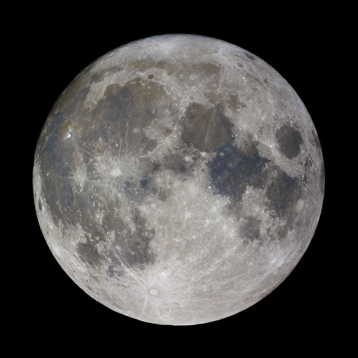
Moon Phase
Waxing gibbous
Sunset
07:50 PM
Hourly Forecast
Tue, 11:00 AM
SunnyWinds: 5 mph S
60°
Tue, 12:00 PM
SunnyWinds: 10 mph S
62°
Tue, 01:00 PM
SunnyWinds: 10 mph S
64°
Tue, 02:00 PM
SunnyWinds: 10 mph S
66°
Tue, 03:00 PM
SunnyWinds: 10 mph S
66°
Tue, 04:00 PM
SunnyWinds: 15 mph S
67°
Tue, 05:00 PM
SunnyWinds: 15 mph S
66°
Tue, 06:00 PM
Mostly ClearWinds: 15 mph S
65°
Tue, 07:00 PM
Mostly ClearWinds: 15 mph S
63°
Tue, 08:00 PM
Partly CloudyWinds: 15 mph S
61°
Tue, 09:00 PM
Partly CloudyWinds: 15 mph S
60°
Tue, 10:00 PM
Mostly CloudyWinds: 15 mph S
59°
Tue, 11:00 PM
Mostly CloudyWinds: 15 mph S
59°
Wed, 12:00 AM
Mostly CloudyWinds: 15 mph S
58°
Wed, 01:00 AM
Mostly CloudyWinds: 15 mph S
58°
Wed, 02:00 AM
Mostly CloudyWinds: 15 mph S
59°
Wed, 03:00 AM
Mostly CloudyWinds: 15 mph SW
59°
Wed, 04:00 AM
Slight Chance Rain ShowersWinds: 10 mph SW
58°
Wed, 05:00 AM
Slight Chance Rain ShowersWinds: 10 mph SW
58°
Wed, 06:00 AM
Chance Rain ShowersWinds: 10 mph SW
58°
Wed, 07:00 AM
Chance Rain ShowersWinds: 10 mph SW
57°
Wed, 08:00 AM
Chance Rain ShowersWinds: 10 mph SW
58°
Wed, 09:00 AM
Chance Rain ShowersWinds: 10 mph SW
60°
Wed, 10:00 AM
Chance Rain ShowersWinds: 10 mph W
62°
Winds: 5 to 15 mph S
Sunny, with a high near 68. South wind 5 to 15 mph.
Winds: 10 to 15 mph S
A slight chance of rain showers after 4am. Mostly cloudy, with a low around 56. South wind 10 to 15 mph. Chance of precipitation is 20%. New rainfall amounts less than a tenth of an inch possible.
Winds: 10 to 15 mph W
A chance of rain showers before 5pm. Partly sunny, with a high near 71. West wind 10 to 15 mph. Chance of precipitation is 30%. New rainfall amounts less than a tenth of an inch possible.
Winds: 10 to 15 mph N
Partly cloudy, with a low around 45. North wind 10 to 15 mph.
Winds: 5 to 10 mph NE
Mostly sunny, with a high near 58. Northeast wind 5 to 10 mph.
Winds: 5 to 10 mph E
Mostly clear, with a low around 44.
Winds: 5 to 10 mph E
Sunny, with a high near 64.
Winds: 10 to 15 mph SE
Partly cloudy, with a low around 48.
Winds: 10 to 15 mph SE
Partly sunny, with a high near 66.
Winds: 15 mph S
Mostly cloudy, with a low around 57.
Winds: 10 to 15 mph S
Mostly sunny, with a high near 76.
Winds: 10 to 15 mph S
Partly cloudy, with a low around 62.
Winds: 10 mph S
A slight chance of showers and thunderstorms after 2pm. Mostly sunny, with a high near 80.
Winds: 10 to 15 mph S
A chance of showers and thunderstorms. Partly cloudy, with a low around 63. Chance of precipitation is 30%.
Coastal Waters Forecast
National Weather Service Baltimore MD/Washington DC
FOR THE TIDAL POTOMAC AND MD PORTION OF THE CHESAPEAKE BAY.
Tidal Potomac River and Maryland portion of Chesapeake Bay. Forecasts of wave heights do not include effects of wind direction relative to tidal currents. Expect higher waves when winds are blowing against the tidal flow. High pressure will move offshore later today. A cold front will cross the area Wednesday. High pressure will return for the end of the week. Small Craft Advisories will likely be needed through Thursday morning, and again Friday afternoon and Saturday afternoon.
SMALL CRAFT ADVISORY IN EFFECT THROUGH WEDNESDAY AFTERNOON
SMALL CRAFT ADVISORY IN EFFECT THROUGH WEDNESDAY AFTERNOON
SMALL CRAFT ADVISORY IN EFFECT THROUGH WEDNESDAY AFTERNOON
SMALL CRAFT ADVISORY IN EFFECT THROUGH WEDNESDAY AFTERNOON
SMALL CRAFT ADVISORY IN EFFECT THROUGH WEDNESDAY AFTERNOON
SMALL CRAFT ADVISORY IN EFFECT THROUGH WEDNESDAY AFTERNOON
SMALL CRAFT ADVISORY IN EFFECT THROUGH WEDNESDAY AFTERNOON
SMALL CRAFT ADVISORY IN EFFECT THROUGH WEDNESDAY AFTERNOON
SMALL CRAFT ADVISORY IN EFFECT THROUGH WEDNESDAY AFTERNOON
SMALL CRAFT ADVISORY IN EFFECT THROUGH WEDNESDAY AFTERNOON
SMALL CRAFT ADVISORY IN EFFECT THROUGH WEDNESDAY AFTERNOON
SMALL CRAFT ADVISORY IN EFFECT THROUGH WEDNESDAY AFTERNOON
SMALL CRAFT ADVISORY IN EFFECT THROUGH WEDNESDAY AFTERNOON
SMALL CRAFT ADVISORY IN EFFECT THROUGH WEDNESDAY AFTERNOON
Oilrig
NWS
Buoy
Fixed Station
USGS
Ship
Other


Search Results
