Tall Timbers,
MD
06/30/2025 05:00 PM
85°F
TEMPERATURE
Winds 10 mph S
Scattered Showers And Thunderstorms
Scattered showers and thunderstorms. Partly sunny, with a high near 86. South wind around 10 mph. Chance of precipitation is 50%. New rainfall amounts less than a tenth of an inch possible.
Moonrise
12:13 PM
Moonset
-
Sunrise
05:46 AM
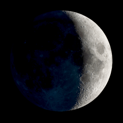
Moon Phase
Waxing crescent
Sunset
08:33 PM
Hourly Forecast
Mon, 05:00 PM
Scattered Showers And ThunderstormsWinds: 10 mph S
85°
Mon, 06:00 PM
Scattered Showers And ThunderstormsWinds: 10 mph S
85°
Mon, 07:00 PM
Scattered Showers And ThunderstormsWinds: 9 mph S
84°
Mon, 08:00 PM
Isolated Showers And ThunderstormsWinds: 8 mph S
85°
Mon, 09:00 PM
Isolated Showers And ThunderstormsWinds: 8 mph S
85°
Mon, 10:00 PM
Isolated Showers And ThunderstormsWinds: 9 mph S
84°
Mon, 11:00 PM
Slight Chance Showers And ThunderstormsWinds: 10 mph S
84°
Tue, 12:00 AM
Mostly CloudyWinds: 10 mph S
83°
Tue, 01:00 AM
Mostly CloudyWinds: 12 mph SW
83°
Tue, 02:00 AM
Partly CloudyWinds: 13 mph SW
83°
Tue, 03:00 AM
Partly CloudyWinds: 13 mph SW
82°
Tue, 04:00 AM
Partly CloudyWinds: 13 mph SW
82°
Tue, 05:00 AM
Partly CloudyWinds: 13 mph SW
81°
Tue, 06:00 AM
Mostly SunnyWinds: 13 mph SW
80°
Tue, 07:00 AM
SunnyWinds: 13 mph SW
80°
Tue, 08:00 AM
SunnyWinds: 13 mph SW
80°
Tue, 09:00 AM
SunnyWinds: 13 mph SW
81°
Tue, 10:00 AM
SunnyWinds: 13 mph SW
82°
Tue, 11:00 AM
Mostly SunnyWinds: 13 mph SW
83°
Tue, 12:00 PM
Slight Chance Showers And ThunderstormsWinds: 13 mph SW
84°
Tue, 01:00 PM
Chance Showers And ThunderstormsWinds: 13 mph SW
84°
Tue, 02:00 PM
Chance Showers And ThunderstormsWinds: 13 mph SW
84°
Tue, 03:00 PM
Chance Showers And ThunderstormsWinds: 13 mph SW
85°
Tue, 04:00 PM
Chance Showers And ThunderstormsWinds: 12 mph SW
85°
Winds: 10 mph S
Scattered showers and thunderstorms. Partly sunny, with a high near 86. South wind around 10 mph. Chance of precipitation is 50%. New rainfall amounts less than a tenth of an inch possible.
Winds: 8 to 13 mph S
Scattered showers and thunderstorms before midnight. Partly cloudy, with a low around 80. South wind 8 to 13 mph, with gusts as high as 23 mph. Chance of precipitation is 50%. New rainfall amounts less than a tenth of an inch possible.
Winds: 13 mph SW
A slight chance of showers and thunderstorms between noon and 1pm, then a chance of showers and thunderstorms between 1pm and 2pm, then a chance of showers and thunderstorms. Mostly sunny, with a high near 87. Southwest wind around 13 mph, with gusts as high as 23 mph. Chance of precipitation is 50%. New rainfall amounts between a tenth and quarter of an inch possible.
Winds: 6 to 10 mph W
Showers and thunderstorms likely before 8pm, then showers and thunderstorms. Mostly cloudy, with a low around 75. West wind 6 to 10 mph, with gusts as high as 21 mph. Chance of precipitation is 90%. New rainfall amounts between three quarters and one inch possible.
Winds: 6 mph SW
Showers and thunderstorms likely before 2pm, then a slight chance of showers and thunderstorms. Mostly cloudy, with a high near 79. Southwest wind around 6 mph. Chance of precipitation is 70%.
Winds: 5 mph SW
A slight chance of showers and thunderstorms before 8pm. Partly cloudy, with a low around 75. Chance of precipitation is 20%.
Winds: 6 mph NW
Sunny, with a high near 84.
Winds: 6 mph W
Mostly clear, with a low around 74.
Winds: 7 mph N
Sunny, with a high near 82.
Winds: 2 to 6 mph S
Mostly clear, with a low around 74.
Winds: 2 to 8 mph S
Mostly sunny, with a high near 84.
Winds: 9 mph S
Partly cloudy, with a low around 76.
Winds: 7 to 10 mph S
Mostly sunny, with a high near 86.
Winds: 8 to 12 mph S
Partly cloudy, with a low around 78.
Coastal Waters Forecast
National Weather Service Baltimore MD/Washington DC
FOR THE TIDAL POTOMAC AND MD PORTION OF THE CHESAPEAKE BAY.
Tidal Potomac River and Maryland portion of Chesapeake Bay. Forecasts of wave heights do not include effects of wind direction relative to tidal currents. Expect higher waves when winds are blowing against the tidal flow. Waves flat where waters are iced over. A cold front will approach the water on Tuesday, and eventually move through Tuesday night. High pressure will build in for the middle to end of the week. Small Craft Advisories may be needed on Tuesday. Special Marine Warnings are possible with thunderstorms during the late afternoon and evening hours each day through Tuesday.
REST OF THIS AFTERNOON
S winds 10 kt Waves 1 ft Numerous showers and tstms Vsby 1 NM or less
TONIGHT
S winds 5 to 10 kt Waves 1 ft Numerous showers and tstms Vsby 1 NM or less
TUE
SW winds 5 to 10 kt with gusts to 20 kt Waves 1 ft Showers with tstms likely Vsby 1 NM or less
TUE NIGHT
SW winds around 5 kt Waves 1 ft Showers with tstms likely
WED
W winds around 5 kt Waves 1 ft
WED NIGHT
SW winds around 5 kt Waves 1 ft or less
THU
NW winds around 5 kt Waves 1 ft
FRI
W winds around 5 kt Waves 1 ft or less
SMALL CRAFT ADVISORY IN EFFECT FROM 11 PM EDT THIS EVENING THROUGH LATE TONIGHT
SMALL CRAFT ADVISORY IN EFFECT THROUGH LATE TONIGHT
SMALL CRAFT ADVISORY IN EFFECT FROM 11 PM EDT THIS EVENING THROUGH LATE TONIGHT
SMALL CRAFT ADVISORY IN EFFECT FROM 11 PM EDT THIS EVENING THROUGH LATE TONIGHT
SMALL CRAFT ADVISORY IN EFFECT FROM 11 PM EDT THIS EVENING THROUGH LATE TONIGHT
SMALL CRAFT ADVISORY IN EFFECT FROM 11 PM EDT THIS EVENING THROUGH LATE TONIGHT
SMALL CRAFT ADVISORY IN EFFECT THROUGH LATE TONIGHT
SMALL CRAFT ADVISORY IN EFFECT THROUGH LATE TONIGHT
SMALL CRAFT ADVISORY IN EFFECT THROUGH LATE TONIGHT
SMALL CRAFT ADVISORY IN EFFECT THROUGH LATE TONIGHT
SMALL CRAFT ADVISORY IN EFFECT THROUGH LATE TONIGHT
SMALL CRAFT ADVISORY IN EFFECT THROUGH LATE TONIGHT
SMALL CRAFT ADVISORY IN EFFECT THROUGH LATE TONIGHT
Oilrig
NWS
Buoy
Fixed Station
USGS
Ship
Other


Search Results
