Maine, New Hampshire, Vermont, Massachusetts, Connecticut, Pennsylvania, Rhode Island, New York, New Jersey, Delaware, Maryland, Washington D.C., West Virginia, Virginia, and Kentucky,
MD
07/13/2025 04:49 AM
Sunday
79°F
TEMPERATURE
Winds 14.82 mph SE
Mostly Clear
Weather will be Partly Cloudy.Maximum Temperatures 83 F. Minimum Temperatures 78 F. Windspeed 13.01 SE.
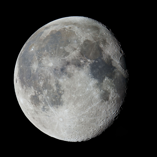
Moonrise
11:35 PM
Moonset
09:36 AM
Sunrise
05:52 AM
Moon Phase
Waning gibbous
Sunset
08:28 PM
Winds: 13.01 mph SE
Weather will be Partly Cloudy.Maximum Temperatures 83 F. Minimum Temperatures 78 F. Windspeed 13.01 SE.
Winds: 14.96 mph SSE
Weather will be Heavy Rain.Maximum Temperatures 83 F. Minimum Temperatures 79 F. Windspeed 14.96 SSE.
Winds: 14.24 mph S
Weather will be Drizzle.Maximum Temperatures 83 F. Minimum Temperatures 79 F. Windspeed 14.24 S.
Winds: 17.8 mph SSW
Weather will be Scattered Thunderstorms.Maximum Temperatures 86 F. Minimum Temperatures 79 F. Windspeed 17.8 SSW.
Winds: 19.94 mph SW
Weather will be Scattered Thunderstorms.Maximum Temperatures 89 F. Minimum Temperatures 80 F. Windspeed 19.94 SW.
Winds: 13.92 mph WSW
Weather will be Scattered Thunderstorms.Maximum Temperatures 88 F. Minimum Temperatures 82 F. Windspeed 13.92 WSW.
Winds: 8.77 mph NNW
Weather will be Scattered Thunderstorms.Maximum Temperatures 85 F. Minimum Temperatures 82 F. Windspeed 8.77 NNW.
Winds: 14.97 mph SSW
Weather will be Scattered Thunderstorms.Maximum Temperatures 85 F. Minimum Temperatures 81 F. Windspeed 14.97 SSW.
Winds: 22.76 mph NE
Weather will be Scattered Thunderstorms.Maximum Temperatures 84 F. Minimum Temperatures 78 F. Windspeed 22.76 NE.
Coastal Waters Forecast
National Weather Service Baltimore MD/Washington DC
FOR THE TIDAL POTOMAC AND MD PORTION OF THE CHESAPEAKE BAY.
Tidal Potomac River and Maryland portion of Chesapeake Bay. Forecasts of wave heights do not include effects of wind direction relative to tidal currents. Expect higher waves when winds are blowing against the tidal flow. Waves flat where waters are iced over. High pressure will remain in place offshore through the upcoming week. A weak cold front may move over the waters on Monday, before stalling out and dissipating.
OVERNIGHT
SE winds 5 kt Waves less than 1 ft A slight chance of showers
SUN
SE winds around 5 kt Waves 1 ft A chance of showers and tstms Vsby 1 NM or less
SUN NIGHT
SE winds around 5 kt Waves 1 ft A chance of showers and tstms Vsby 1 NM or less
MON
S winds around 5 kt Waves 1 ft Showers and tstms likely
MON NIGHT
S winds around 5 kt Waves 1 ft or less A chance of showers and tstms
TUE
S winds around 5 kt Waves 1 ft or less Showers likely with a chance of tstms
TUE NIGHT
S winds around 5 kt Waves 1 ft A chance of showers and tstms
WED
S winds around 5 kt Waves 1 ft A chance of showers in the morning, then showers likely with a chance of tstms through the night
THU
SW winds 5 to 10 kt Waves 1 ft A chance of showers and tstms
OVERNIGHT
SE winds 5 kt Waves less than 1 ft
SUN
SE winds around 5 kt Waves 1 ft A chance of showers and tstms Vsby 1 NM or less
SUN NIGHT
SE winds around 5 kt Waves 1 ft A chance of showers and tstms Vsby 1 NM or less
MON
S winds around 5 kt Waves 1 ft Showers likely with a chance of tstms
MON NIGHT
S winds around 5 kt Waves 1 ft or less A chance of showers and tstms
TUE
S winds around 5 kt Waves 1 ft or less Showers likely with a chance of tstms
TUE NIGHT
S winds 5 kt Waves less than 1 ft A chance of showers and tstms
WED
S winds 5 to 10 kt Waves 1 ft A chance of showers in the morning, then showers likely with a chance of tstms through the night
THU
SW winds 5 to 10 kt Waves 1 ft A chance of showers and tstms through the night
OVERNIGHT
SE winds 5 kt Waves less than 1 ft
SUN
SE winds 5 to 10 kt Waves 1 ft A chance of showers and tstms Vsby 1 NM or less
SUN NIGHT
SE winds 5 to 10 kt Waves 1 ft A chance of showers and tstms Vsby 1 NM or less
MON
S winds 5 to 10 kt Waves 1 ft A chance of showers and tstms
MON NIGHT
S winds 5 to 10 kt Waves 1 ft or less A chance of showers and tstms
TUE
S winds around 5 kt Waves 1 ft or less Showers likely with a chance of tstms
TUE NIGHT
S winds 5 kt Waves less than 1 ft A chance of showers and tstms
WED
SW winds 5 to 10 kt Waves 1 ft A chance of showers in the morning, then showers likely with a chance of tstms through the night
THU
SW winds 5 to 10 kt Waves 1 ft A chance of showers through the night A chance of tstms
OVERNIGHT
SE winds 5 kt Waves less than 1 ft
SUN
SE winds 5 kt Waves less than 1 ft A chance of showers and tstms
SUN NIGHT
SE winds 5 kt Waves less than 1 ft A chance of showers and tstms Vsby 1 NM or less
MON
S winds around 5 kt Waves 1 ft Tstms likely with a chance of showers
MON NIGHT
S winds around 5 kt Waves 1 ft or less A chance of showers and tstms
TUE
S winds around 5 kt Waves 1 ft or less Showers likely with a chance of tstms
TUE NIGHT
S winds 5 kt Waves less than 1 ft A chance of showers and tstms
WED
S winds 5 to 10 kt Waves 1 ft Showers likely with a chance of tstms
THU
SW winds 5 to 10 kt Waves 1 ft Showers likely through the night A chance of tstms A chance of showers after midnight
OVERNIGHT
SE winds 5 kt Waves less than 1 ft
SUN
SE winds 5 kt Waves less than 1 ft A chance of showers and tstms
SUN NIGHT
SE winds 5 kt Waves less than 1 ft A chance of showers and tstms Vsby 1 NM or less
MON
S winds 5 kt Waves flat Showers and tstms likely
MON NIGHT
SW winds around 5 kt Waves flat A chance of showers and tstms
TUE
S winds around 5 kt Waves flat Showers likely with a chance of tstms
TUE NIGHT
S winds 5 kt Waves less than 1 ft A chance of showers and tstms
WED
S winds 5 to 10 kt Waves 1 ft Showers likely with a chance of tstms
THU
SW winds 5 to 10 kt Waves 1 ft Showers likely through the night A chance of tstms A chance of showers after midnight
OVERNIGHT
SE winds 5 kt Waves less than 1 ft
SUN
SE winds 5 kt Waves less than 1 ft A chance of showers and tstms
SUN NIGHT
SE winds around 5 kt Waves 1 ft or less A chance of showers and tstms Vsby 1 NM or less
MON
S winds around 5 kt Waves flat Showers and tstms likely
MON NIGHT
S winds around 5 kt Waves flat A chance of showers and tstms
TUE
S winds around 5 kt Waves flat Showers likely with a chance of tstms
TUE NIGHT
S winds around 5 kt Waves flat A chance of showers and tstms
WED
S winds 5 to 10 kt Waves 1 ft or less Showers likely with a chance of tstms
THU
SW winds 5 kt Waves less than 1 ft Showers likely through the night A chance of tstms A chance of showers after midnight
OVERNIGHT
SE winds 5 kt Waves less than 1 ft
SUN
SE winds 5 kt Waves flat A chance of showers and tstms
SUN NIGHT
SE winds 5 kt Waves less than 1 ft A chance of showers and tstms Vsby 1 NM or less
MON
S winds 5 kt Waves flat Showers and tstms likely
MON NIGHT
S winds around 5 kt Waves flat A chance of showers and tstms
TUE
S winds around 5 kt Waves flat Showers likely with a chance of tstms
TUE NIGHT
S winds 5 kt Waves flat A chance of showers and tstms
WED
S winds 5 to 10 kt Waves 1 ft Showers likely with a chance of tstms
THU
SW winds 5 to 10 kt Waves 1 ft A chance of showers and tstms
OVERNIGHT
SE winds 5 kt Waves less than 1 ft
SUN
SE winds 5 kt Waves less than 1 ft A chance of showers and tstms
SUN NIGHT
S winds 5 to 10 kt Waves 1 ft A chance of showers and tstms
MON
S winds 5 kt Waves less than 1 ft Showers likely with a chance of tstms
MON NIGHT
S winds around 5 kt Waves 1 ft or less A chance of showers and tstms
TUE
S winds around 5 kt Waves 1 ft or less Showers likely with a chance of tstms
TUE NIGHT
S winds 5 to 10 kt Waves 1 ft A chance of showers and tstms
WED
S winds 5 to 10 kt Waves 1 to 2 ft Showers likely with a chance of tstms
THU
SW winds 5 to 10 kt Waves 1 ft A chance of showers and tstms
OVERNIGHT
SE winds 5 kt Waves less than 1 ft
SUN
SE winds 5 kt Waves flat A chance of showers and tstms
SUN NIGHT
S winds 5 kt Waves less than 1 ft A chance of showers and tstms
MON
S winds 5 kt Waves flat Showers and tstms likely
MON NIGHT
S winds around 5 kt Waves flat A chance of showers and tstms
TUE
SW winds 5 kt Waves flat Showers likely with a chance of tstms
TUE NIGHT
S winds 5 kt Waves flat A chance of showers and tstms
WED
S winds 5 to 10 kt Waves 1 ft Showers likely with a chance of tstms
THU
SW winds 5 to 10 kt Waves 1 ft A chance of showers and tstms
OVERNIGHT
SE winds 5 kt Waves less than 1 ft
SUN
SE winds 5 kt Waves less than 1 ft A chance of showers and tstms
SUN NIGHT
S winds 5 to 10 kt Waves 1 ft A chance of showers and tstms Vsby 1 NM or less
MON
S winds 5 kt Waves less than 1 ft Showers likely with a chance of tstms
MON NIGHT
S winds 5 kt Waves less than 1 ft A chance of showers and tstms
TUE
S winds around 5 kt Waves 1 ft or less Showers likely with a chance of tstms
TUE NIGHT
S winds 5 to 10 kt Waves 1 ft A chance of showers and tstms
WED
S winds 5 to 10 kt Waves 1 to 2 ft Showers likely with a chance of tstms
THU
SW winds 5 to 10 kt Waves 1 ft A chance of showers and tstms
OVERNIGHT
SE winds 5 kt Waves less than 1 ft
SUN
SE winds 5 kt Waves less than 1 ft A chance of showers and tstms
SUN NIGHT
S winds 5 kt Waves less than 1 ft A chance of showers and tstms Vsby 1 NM or less
MON
S winds 5 kt Waves flat Showers likely with a chance of tstms
MON NIGHT
S winds around 5 kt Waves flat A chance of showers and tstms
TUE
SW winds around 5 kt Waves flat Showers likely with a chance of tstms
TUE NIGHT
S winds 5 kt Waves less than 1 ft A chance of showers and tstms
WED
S winds 5 to 10 kt Waves 1 ft Showers likely with a chance of tstms
THU
SW winds 5 to 10 kt Waves 1 ft A chance of showers and tstms
OVERNIGHT
SE winds 5 kt Waves less than 1 ft
SUN
SE winds 5 kt Waves less than 1 ft A chance of showers and tstms
SUN NIGHT
SE winds around 5 kt Waves 1 ft A chance of showers and tstms
MON
S winds around 5 kt Waves 1 ft Showers likely with a chance of tstms
MON NIGHT
S winds around 5 kt Waves 1 ft A chance of showers and tstms
TUE
S winds around 5 kt Waves 1 ft Showers likely with a chance of tstms
TUE NIGHT
S winds 5 kt Waves less than 1 ft A chance of showers and tstms
WED
S winds 5 to 10 kt Waves 1 ft Showers likely with a chance of tstms
THU
SW winds 5 to 10 kt Waves 1 ft A chance of showers and tstms
OVERNIGHT
SE winds 5 kt Waves less than 1 ft
SUN
SE winds 5 to 10 kt Waves 1 ft
SUN NIGHT
SE winds 5 to 10 kt Waves 1 ft
MON
S winds 5 to 10 kt Waves 1 ft Showers likely with a chance of tstms
MON NIGHT
S winds 5 to 10 kt Waves 1 ft A chance of showers and tstms
TUE
S winds 5 to 10 kt Waves 1 ft Showers likely with a chance of tstms
TUE NIGHT
S winds 5 to 10 kt Waves 1 ft A chance of showers and tstms
WED
SW winds 10 to 15 kt Waves 1 to 2 ft A chance of showers A chance of tstms
THU
SW winds 10 to 15 kt Waves 2 ft A chance of showers A chance of tstms
OVERNIGHT
SE winds 5 kt Waves less than 1 ft
SUN
SE winds 5 kt Waves less than 1 ft
SUN NIGHT
SE winds 5 to 10 kt Waves 1 ft
MON
S winds 5 to 10 kt Waves 1 ft A chance of showers and tstms
MON NIGHT
S winds 5 to 10 kt Waves 1 ft A chance of showers and tstms
TUE
SW winds 5 to 10 kt Waves 1 ft or less Showers likely with a chance of tstms
TUE NIGHT
S winds 5 to 10 kt Waves 1 ft A chance of showers and tstms
WED
SW winds 10 to 15 kt Waves 1 to 2 ft A chance of showers and tstms
THU
SW winds 10 to 15 kt Waves 1 to 2 ft A chance of showers A chance of tstms
Oilrig
NWS
Buoy
Fixed Station
USGS
Ship
Other


Search Results
