Anglers may fish anywhere in the State of Virginia provided it is open to the public and is public access (launches). No private ponds, lakes, military bases, etc.,
VA
07/01/2025 10:00 PM
86°F
TEMPERATURE
Winds 15 mph SW
Slight Chance Showers And Thunderstorms
A chance of showers and thunderstorms. Mostly cloudy, with a low around 77. Southwest wind around 15 mph, with gusts as high as 23 mph. Chance of precipitation is 30%. New rainfall amounts less than a tenth of an inch possible.
Moonrise
01:15 PM
Moonset
01:06 AM
Sunrise
05:49 AM
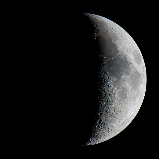
Moon Phase
Waxing crescent
Sunset
08:29 PM
Hourly Forecast
Tue, 10:00 PM
Slight Chance Showers And ThunderstormsWinds: 15 mph SW
86°
Tue, 11:00 PM
Slight Chance Showers And ThunderstormsWinds: 15 mph SW
84°
Wed, 12:00 AM
Slight Chance Showers And ThunderstormsWinds: 15 mph SW
82°
Wed, 01:00 AM
Slight Chance Showers And ThunderstormsWinds: 14 mph SW
81°
Wed, 02:00 AM
Chance Showers And ThunderstormsWinds: 13 mph SW
80°
Wed, 03:00 AM
Chance Showers And ThunderstormsWinds: 14 mph SW
79°
Wed, 04:00 AM
Slight Chance Showers And ThunderstormsWinds: 14 mph SW
79°
Wed, 05:00 AM
Chance Showers And ThunderstormsWinds: 14 mph SW
78°
Wed, 06:00 AM
Chance Showers And ThunderstormsWinds: 13 mph SW
77°
Wed, 07:00 AM
Chance Showers And ThunderstormsWinds: 13 mph SW
78°
Wed, 08:00 AM
Chance Showers And ThunderstormsWinds: 12 mph SW
78°
Wed, 09:00 AM
Chance Showers And ThunderstormsWinds: 12 mph SW
79°
Wed, 10:00 AM
Chance Showers And ThunderstormsWinds: 12 mph SW
80°
Wed, 11:00 AM
Showers And Thunderstorms LikelyWinds: 12 mph SW
81°
Wed, 12:00 PM
Showers And Thunderstorms LikelyWinds: 10 mph SW
82°
Wed, 01:00 PM
Showers And ThunderstormsWinds: 10 mph W
81°
Wed, 02:00 PM
Showers And ThunderstormsWinds: 10 mph W
81°
Wed, 03:00 PM
Showers And ThunderstormsWinds: 10 mph W
81°
Wed, 04:00 PM
Showers And ThunderstormsWinds: 9 mph W
81°
Wed, 05:00 PM
Showers And Thunderstorms LikelyWinds: 9 mph NW
80°
Wed, 06:00 PM
Showers And Thunderstorms LikelyWinds: 8 mph SW
80°
Wed, 07:00 PM
Chance Showers And ThunderstormsWinds: 6 mph SW
79°
Wed, 08:00 PM
Chance Showers And ThunderstormsWinds: 6 mph S
78°
Wed, 09:00 PM
Chance Showers And ThunderstormsWinds: 6 mph SW
77°
Winds: 15 mph SW
A chance of showers and thunderstorms. Mostly cloudy, with a low around 77. Southwest wind around 15 mph, with gusts as high as 23 mph. Chance of precipitation is 30%. New rainfall amounts less than a tenth of an inch possible.
Winds: 9 to 13 mph W
A chance of showers and thunderstorms before 11am, then showers and thunderstorms between 11am and 5pm, then showers and thunderstorms likely. Some of the storms could produce heavy rain. Mostly cloudy, with a high near 85. West wind 9 to 13 mph. Chance of precipitation is 90%. New rainfall amounts between 1 and 2 inches possible.
Winds: 5 to 8 mph SW
Showers and thunderstorms likely. Mostly cloudy, with a low around 74. Southwest wind 5 to 8 mph. Chance of precipitation is 60%. New rainfall amounts between 1 and 2 inches possible.
Winds: 6 mph N
A slight chance of rain showers before 8am. Sunny, with a high near 90. North wind around 6 mph. Chance of precipitation is 20%. New rainfall amounts less than a tenth of an inch possible.
Winds: 2 to 6 mph S
Mostly clear, with a low around 77. South wind 2 to 6 mph.
Winds: 6 to 10 mph N
Sunny, with a high near 88.
Winds: 2 to 8 mph SE
Clear, with a low around 75.
Winds: 3 to 9 mph NE
Sunny, with a high near 89.
Winds: 5 to 9 mph SE
Partly cloudy, with a low around 74.
Winds: 5 to 10 mph S
Mostly sunny, with a high near 89.
Winds: 7 to 10 mph S
Partly cloudy, with a low around 75.
Winds: 7 to 10 mph S
A slight chance of showers and thunderstorms after 2pm. Mostly sunny, with a high near 92.
Winds: 7 to 10 mph S
A slight chance of showers and thunderstorms before 2am. Partly cloudy, with a low around 76.
Winds: 7 to 10 mph S
A slight chance of showers and thunderstorms after 2pm. Mostly sunny, with a high near 94.
Coastal Waters Forecast for Virginia
National Weather Service Wakefield VA
for Fenwick Island DE to Currituck Beach Light NC out 20 nautical miles including Virginia portion of the Chesapeake Bay, Currituck Sound and portions of the James, York, and Rappahannock Rivers.
Virginia Portion of the Chesapeake Bay, Currituck Sound and Atlantic Coastal Waters from Fenwick Island DE to Currituck Beach Light NC out 20 nautical miles A stronger cold front is forecast to drop across the region tonight into Wednesday, bringing elevated winds and seas. Benign marine conditions are expected to return thereafter.
SMALL CRAFT ADVISORY IN EFFECT UNTIL 4 AM EDT WEDNESDAY
SEVERE THUNDERSTORM WATCH 481 IN EFFECT UNTIL 9 PM EDT THIS EVENING
SMALL CRAFT ADVISORY IN EFFECT UNTIL 4 AM EDT WEDNESDAY
SMALL CRAFT ADVISORY IN EFFECT UNTIL 7 AM EDT WEDNESDAY
SMALL CRAFT ADVISORY IN EFFECT UNTIL 7 AM EDT WEDNESDAY
SMALL CRAFT ADVISORY IN EFFECT UNTIL 4 AM EDT WEDNESDAY
SEVERE THUNDERSTORM WATCH 481 IN EFFECT UNTIL 9 PM EDT THIS EVENING
SMALL CRAFT ADVISORY IN EFFECT UNTIL 4 AM EDT WEDNESDAY
SMALL CRAFT ADVISORY IN EFFECT UNTIL 7 AM EDT WEDNESDAY
SMALL CRAFT ADVISORY IN EFFECT UNTIL 7 AM EDT WEDNESDAY
SMALL CRAFT ADVISORY IN EFFECT UNTIL 7 AM EDT WEDNESDAY
SMALL CRAFT ADVISORY IN EFFECT UNTIL 7 AM EDT WEDNESDAY
SEVERE THUNDERSTORM WATCH 481 IN EFFECT UNTIL 9 PM EDT THIS EVENING
TONIGHT
SW winds 10 to 15 kt with gusts up to 25 kt Waves 1 to 2 ft A slight chance of showers and tstms early this evening, then a chance of showers and tstms late this evening and overnight
WED
SW winds 10 to 15 kt with gusts up to 20 kt, becoming W 5 to 10 kt with gusts up to 15 kt in the late morning and early afternoon, then becoming NW late Waves 1 to 2 ft, diminishing to around 1 foot in the late morning and afternoon A chance of tstms in the morning Showers Tstms likely in the afternoon
WED NIGHT
W winds 5 kt Waves 1 foot or less and light chop A chance of tstms in the evening A chance of showers
THU
NW winds 5 kt, becoming NE in the afternoon Waves 1 foot or less and light chop
THU NIGHT
SE winds 5 kt, becoming W after midnight Waves 1 foot or less and light chop
FRI
N winds 5 to 10 kt Waves around 1 foot
FRI NIGHT
E winds 5 to 10 kt, becoming S after midnight Waves around 1 foot, diminishing to 1 foot or less and light chop after midnight
SAT
N winds 5 kt, becoming E in the afternoon Waves 1 foot or less and light chop, increasing to around 1 foot in the afternoon
SAT NIGHT
S winds 5 to 10 kt Waves around 1 foot
SUN
S winds 5 to 10 kt Gusts up to 15 kt in the afternoon Waves around 1 foot
SUN NIGHT
S winds 5 to 10 kt Gusts up to 15 kt in the evening Waves around 1 foot
TONIGHT
SW winds 10 to 15 kt with gusts up to 25 kt Waves 1 to 2 ft A slight chance of showers and tstms early this evening, then a chance of showers and tstms late this evening and overnight
WED
SW winds 10 to 15 kt with gusts up to 20 kt, becoming W 5 to 10 kt with gusts up to 15 kt in the afternoon Waves 1 to 2 ft, diminishing to around 1 foot in the afternoon A chance of tstms in the morning Showers Tstms likely in the afternoon
WED NIGHT
W winds 5 kt Waves 1 foot or less and light chop A chance of tstms in the evening A chance of showers
THU
NW winds 5 kt, becoming NE in the afternoon Waves 1 foot or less and light chop
THU NIGHT
SE winds 5 kt, becoming W after midnight Waves 1 foot or less and light chop
FRI
N winds 5 to 10 kt Waves around 1 foot
FRI NIGHT
E winds 5 to 10 kt, becoming S after midnight Waves around 1 foot, diminishing to 1 foot or less and light chop after midnight
SAT
N winds 5 kt, becoming E in the afternoon Waves 1 foot or less and light chop, increasing to around 1 foot in the afternoon
SAT NIGHT
SE winds 5 to 10 kt, becoming S after midnight Waves around 1 foot, diminishing to 1 foot or less and light chop after midnight
SUN
S winds 5 to 10 kt Waves around 1 foot
SUN NIGHT
S winds 5 to 10 kt Waves around 1 foot
SMALL CRAFT ADVISORY IN EFFECT UNTIL 7 AM EDT WEDNESDAY
Oilrig
NWS
Buoy
Fixed Station
USGS
Ship
Other


Search Results
