Town Creek Marina,
NC
07/27/2024 03:00 AM
76°F
TEMPERATURE
Winds 10 mph NE
Chance Showers And Thunderstorms
A chance of showers and thunderstorms. Mostly cloudy, with a low around 74. Northeast wind around 12 mph, with gusts as high as 16 mph. Chance of precipitation is 50%. New rainfall amounts between a quarter and half of an inch possible.
Moonrise
12:37 AM
Moonset
12:57 PM
Sunrise
06:12 AM
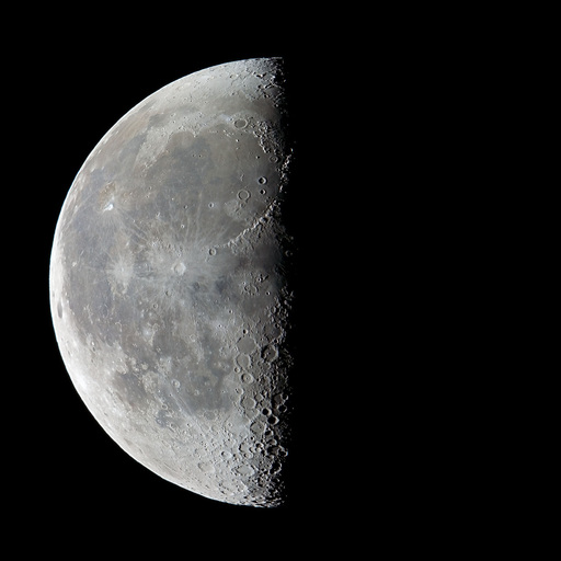
Moon Phase
Waning gibbous
Sunset
08:13 PM
Hourly Forecast
Sat, 03:00 AM
Chance Showers And ThunderstormsWinds: 10 mph NE
76°
Sat, 04:00 AM
Chance Showers And ThunderstormsWinds: 12 mph NE
75°
Sat, 05:00 AM
Chance Showers And ThunderstormsWinds: 12 mph NE
74°
Sat, 06:00 AM
Chance Showers And ThunderstormsWinds: 13 mph NE
74°
Sat, 07:00 AM
Chance Rain ShowersWinds: 13 mph NE
75°
Sat, 08:00 AM
Chance Rain ShowersWinds: 14 mph NE
75°
Sat, 09:00 AM
Chance Rain ShowersWinds: 15 mph NE
76°
Sat, 10:00 AM
Chance Rain ShowersWinds: 16 mph NE
77°
Sat, 11:00 AM
Chance Rain ShowersWinds: 17 mph NE
79°
Sat, 12:00 PM
Chance Rain ShowersWinds: 17 mph NE
80°
Sat, 01:00 PM
Slight Chance Rain ShowersWinds: 17 mph NE
81°
Sat, 02:00 PM
Slight Chance Rain ShowersWinds: 16 mph NE
83°
Sat, 03:00 PM
Slight Chance Rain ShowersWinds: 16 mph NE
83°
Sat, 04:00 PM
Mostly SunnyWinds: 16 mph NE
83°
Sat, 05:00 PM
Mostly SunnyWinds: 16 mph NE
83°
Sat, 06:00 PM
Partly CloudyWinds: 16 mph NE
81°
Sat, 07:00 PM
Mostly ClearWinds: 15 mph NE
79°
Sat, 08:00 PM
Mostly ClearWinds: 15 mph NE
77°
Sat, 09:00 PM
Mostly ClearWinds: 14 mph NE
75°
Sat, 10:00 PM
Mostly ClearWinds: 14 mph NE
74°
Sat, 11:00 PM
Mostly ClearWinds: 13 mph NE
73°
Sun, 12:00 AM
Mostly ClearWinds: 12 mph N
72°
Sun, 01:00 AM
Mostly ClearWinds: 12 mph N
71°
Sun, 02:00 AM
Mostly ClearWinds: 10 mph N
71°
Winds: 12 mph NE
A chance of showers and thunderstorms. Mostly cloudy, with a low around 74. Northeast wind around 12 mph, with gusts as high as 16 mph. Chance of precipitation is 50%. New rainfall amounts between a quarter and half of an inch possible.
Winds: 13 to 17 mph NE
A chance of showers and thunderstorms before 4pm. Partly sunny, with a high near 83. Northeast wind 13 to 17 mph, with gusts as high as 24 mph. Chance of precipitation is 40%. New rainfall amounts between a quarter and half of an inch possible.
Winds: 10 to 16 mph N
Mostly clear, with a low around 70. North wind 10 to 16 mph, with gusts as high as 23 mph.
Winds: 12 mph NE
Sunny, with a high near 86. Northeast wind around 12 mph, with gusts as high as 16 mph.
Winds: 1 to 8 mph SE
Mostly clear, with a low around 72. Southeast wind 1 to 8 mph.
Winds: 2 to 8 mph W
Mostly sunny, with a high near 86.
Winds: 8 mph S
Mostly cloudy, with a low around 77.
Winds: 5 to 12 mph S
A slight chance of showers and thunderstorms after 8am. Partly sunny, with a high near 87.
Winds: 10 mph S
A slight chance of showers and thunderstorms before 2am, then a chance of showers and thunderstorms. Partly cloudy, with a low around 77. Chance of precipitation is 30%.
Winds: 7 to 12 mph SW
A chance of showers and thunderstorms before 2pm, then a chance of showers and thunderstorms. Mostly sunny, with a high near 88. Chance of precipitation is 40%.
Winds: 10 mph SW
A chance of showers and thunderstorms before 2am, then a chance of showers and thunderstorms. Partly cloudy, with a low around 78. Chance of precipitation is 40%.
Winds: 8 to 12 mph SW
A chance of showers and thunderstorms before 2pm, then a chance of showers and thunderstorms. Mostly sunny, with a high near 89. Chance of precipitation is 40%.
Winds: 10 mph SW
A chance of showers and thunderstorms before 2am, then a chance of showers and thunderstorms. Partly cloudy, with a low around 78. Chance of precipitation is 30%.
Winds: 7 to 10 mph SW
A chance of showers and thunderstorms before 2pm, then a chance of showers and thunderstorms. Mostly sunny, with a high near 89. Chance of precipitation is 30%.
Coastal Waters Forecast for North Carolina
National Weather Service Newport/Morehead City NC
for Eastern North Carolina coastal waters. A cold front will sink south and offshore tonight. Low pressure will move well of the coast Sat as high pressure then builds in from the north Sunday and Monday.
From S of Currituck Beach Light to N of Surf City NC out 20 NM, including the Albemarle and Pamlico Sounds and the Monitor National Marine Sanctuary
REST OF TONIGHT
NE winds around 15 kt Waves around 2 ft A chance of showers
SAT
NE winds 15 to 20 kt Gusts up to 25 kt in the afternoon Waves around 2 ft A chance of showers in the morning
SAT NIGHT
NE winds 10 to 15 kt Waves around 2 ft in the evening, then 1 ft
SUN
NE winds around 10 kt Waves 1 ft or less
SUN NIGHT
E winds 5 to 10 kt, becoming SW after midnight Waves 1 ft or less
MON
SW winds 5 to 10 kt Waves 1 ft or less
MON NIGHT
S winds around 10 kt Waves 1 ft or less
TUE
S winds 5 to 10 kt Waves 1 ft or less
TUE NIGHT
S winds around 10 kt Waves 1 ft or less
WED
S winds around 10 kt Waves 1 ft or less A chance of showers and tstms in the afternoon
WED NIGHT
SW winds around 10 kt Waves 1 ft or less A chance of tstms in the evening A chance of showers
REST OF TONIGHT
NE winds 10 to 15 kt Waves a moderate chop A chance of showers
SAT
NE winds 10 to 15 kt Waves a moderate chop A chance of showers, mainly in the morning
SAT NIGHT
NE winds 10 to 15 kt Waves a moderate chop
SUN
NE winds 5 to 10 kt Waves light chop
SUN NIGHT
E winds around 5 kt, becoming SW after midnight Waves flat
MON
SW winds 5 to 10 kt Waves light chop
MON NIGHT
S winds 5 to 10 kt Waves light chop
TUE
S winds 5 to 10 kt Waves light chop
TUE NIGHT
S winds 5 to 10 kt Waves light chop
WED
S winds 5 to 10 kt Waves light chop A chance of showers and tstms in the afternoon
WED NIGHT
SW winds 5 to 10 kt Waves light chop A chance of tstms in the evening A chance of showers
REST OF TONIGHT
NE winds 10 to 15 kt Waves a moderate chop A slight chance of tstms A chance of showers
SAT
NE winds 15 to 20 kt Gusts up to 25 kt in the afternoon Waves choppy A chance of showers, mainly in the morning
SAT NIGHT
NE winds 15 to 20 kt, diminishing to 10 to 15 kt after midnight Waves choppy, diminishing to a moderate chop after midnight
SUN
NE winds 10 to 15 kt Waves a moderate chop
SUN NIGHT
E winds around 5 kt, becoming SW after midnight Waves flat
MON
SW winds 5 to 10 kt, becoming S in the afternoon Waves light chop
MON NIGHT
S winds around 10 kt Waves light chop
TUE
S winds 5 to 10 kt, increasing to 10 to 15 kt in the afternoon Waves light chop, increasing to a moderate chop in the afternoon
TUE NIGHT
S winds 10 to 15 kt Waves a moderate chop
WED
S winds around 10 kt Waves light chop A chance of showers A chance of tstms in the afternoon
WED NIGHT
SW winds around 10 kt Waves light chop A chance of tstms in the evening A chance of showers
REST OF TONIGHT
NE winds around 15 kt Waves around 2 ft A slight chance of tstms Showers likely, then a chance of showers late
SAT
NE winds 15 to 20 kt with gusts up to 25 kt Waves around 2 ft A chance of showers
SAT NIGHT
NE winds 15 to 20 kt Gusts up to 25 kt in the evening Waves around 2 ft
SUN
NE winds 10 to 15 kt Waves around 2 ft
SUN NIGHT
E winds 5 to 10 kt, becoming S after midnight Waves 1 ft or less
MON
W winds around 5 kt, becoming S in the afternoon Waves 1 ft or less
MON NIGHT
S winds around 10 kt Waves 1 ft or less
TUE
S winds 10 to 15 kt Waves 1 ft or less
TUE NIGHT
S winds 10 to 15 kt Waves 1 ft or less
WED
SW winds 10 to 15 kt Waves 1 ft or less, then around 2 ft in the afternoon A chance of showers A chance of tstms in the afternoon
WED NIGHT
SW winds 10 to 15 kt Waves around 2 ft in the evening, then 1 ft A chance of tstms in the evening A chance of showers
REST OF TONIGHT
NE winds 10 to 15 kt Waves a moderate chop A chance of showers
SAT
NE winds 10 to 15 kt Waves a moderate chop A chance of showers, mainly in the morning
SAT NIGHT
NE winds 10 to 15 kt Waves a moderate chop
SUN
NE winds 5 to 10 kt Waves light chop
SUN NIGHT
E winds around 5 kt, becoming SW after midnight Waves flat
MON
SW winds 5 to 10 kt Waves light chop
MON NIGHT
S winds 5 to 10 kt Waves light chop
TUE
S winds 5 to 10 kt Waves light chop A chance of showers in the afternoon
TUE NIGHT
S winds 5 to 10 kt Waves light chop A chance of showers in the evening
WED
SW winds 5 to 10 kt Waves light chop A chance of showers A chance of tstms in the afternoon
WED NIGHT
SW winds 5 to 10 kt Waves light chop A chance of tstms in the evening A chance of showers
REST OF TONIGHT
NE winds 10 to 15 kt Waves a moderate chop A chance of showers with a slight chance of tstms
SAT
NE winds 15 to 20 kt with gusts up to 25 kt Waves choppy A chance of showers
SAT NIGHT
NE winds 10 to 15 kt Waves a moderate chop
SUN
N winds 10 to 15 kt, becoming NE 5 to 10 kt in the afternoon Waves a moderate chop, diminishing to light chop in the afternoon
SUN NIGHT
E winds 5 to 10 kt, becoming S after midnight Waves light chop, diminishing to flat after midnight
MON
W winds around 5 kt, becoming S in the afternoon Waves flat, increasing to light chop in the afternoon
MON NIGHT
S winds 5 to 10 kt Waves light chop
TUE
S winds 5 to 10 kt Waves light chop A chance of showers in the afternoon
TUE NIGHT
S winds 5 to 10 kt Waves light chop A chance of showers in the evening
WED
SW winds 5 to 10 kt Waves light chop A chance of showers A chance of tstms in the afternoon
WED NIGHT
SW winds 5 to 10 kt Waves light chop A chance of tstms in the evening A chance of showers
REST OF TONIGHT
NE winds 10 to 15 kt Seas around 3 ft Wave Detail: NE 2 ft at 4 seconds and SE 2 ft at 8 seconds A slight chance of tstms A chance of showers
SAT
NE winds 15 to 20 kt Gusts up to 25 kt in the afternoon Seas 3 to 4 ft Wave Detail: NE 3 ft at 5 seconds and SE 2 ft at 8 seconds A chance of showers, mainly in the morning
SAT NIGHT
NE winds 15 to 20 kt Gusts up to 25 kt in the evening Seas around 3 ft Wave Detail: NE 3 ft at 5 seconds and SE 2 ft at 8 seconds
SUN
NE winds 10 to 15 kt Seas 3 to 4 ft Wave Detail: E 3 ft at 7 seconds and NE 2 ft at 5 seconds
SUN NIGHT
E winds 5 to 10 kt, becoming SW after midnight Seas 2 to 3 ft Wave Detail: E 2 ft at 6 seconds and SE 2 ft at 9 seconds
MON
SW winds 5 to 10 kt, becoming S in the afternoon Seas 2 to 3 ft Wave Detail: E 2 ft at 6 seconds and SE 2 ft at 9 seconds
MON NIGHT
S winds around 10 kt Seas 2 to 3 ft
TUE
S winds around 10 kt Seas 2 to 3 ft
TUE NIGHT
S winds around 10 kt Seas 2 to 3 ft
WED
S winds 10 to 15 kt Seas 2 to 3 ft A chance of showers A chance of tstms in the afternoon
WED NIGHT
SW winds 10 to 15 kt Seas 2 to 3 ft A chance of tstms in the evening A chance of showers
REST OF TONIGHT
NE winds 10 to 15 kt Seas around 3 ft Wave Detail: SE 3 ft at 8 seconds and NE 2 ft at 3 seconds A slight chance of tstms Showers likely, then a chance of showers late
SAT
NE winds 15 to 20 kt Gusts up to 25 kt in the afternoon Seas 3 to 4 ft Wave Detail: NE 3 ft at 5 seconds and SE 3 ft at 8 seconds A slight chance of tstms in the morning A chance of showers
SAT NIGHT
NE winds 15 to 20 kt Gusts up to 25 kt in the evening Seas 3 to 4 ft Wave Detail: SE 3 ft at 8 seconds and NE 2 ft at 5 seconds A slight chance of showers in the evening
SUN
N winds 10 to 15 kt Seas 3 to 4 ft Wave Detail: E 3 ft at 6 seconds and S 1 ft at 4 seconds
SUN NIGHT
NE winds 5 to 10 kt, becoming SW after midnight Seas 3 to 4 ft Wave Detail: E 3 ft at 7 seconds and S 1 ft at 4 seconds
MON
W winds around 5 kt, becoming SW in the afternoon Seas around 3 ft Wave Detail: E 3 ft at 9 seconds and NE 2 ft at 6 seconds
MON NIGHT
S winds around 10 kt Seas around 3 ft
TUE
S winds around 10 kt Seas 2 to 3 ft
TUE NIGHT
S winds around 10 kt Seas 2 to 3 ft A chance of showers after midnight
WED
S winds 10 to 15 kt Seas 2 to 3 ft A chance of showers A chance of tstms in the afternoon
WED NIGHT
SW winds 10 to 15 kt Seas 3 to 4 ft A chance of tstms in the evening A chance of showers
REST OF TONIGHT
NE winds 10 to 15 kt Seas around 3 ft Wave Detail: SE 3 ft at 8 seconds and S 2 ft at 5 seconds Showers likely with a slight chance of tstms
SAT
NE winds 15 to 20 kt with gusts up to 25 kt Seas 3 to 5 ft Wave Detail: NE 4 ft at 4 seconds and E 3 ft at 7 seconds A slight chance of tstms in the morning A chance of showers
SAT NIGHT
NE winds 15 to 20 kt Gusts up to 25 kt in the evening Seas 3 to 5 ft Wave Detail: E 3 ft at 7 seconds and S 2 ft at 4 seconds A slight chance of showers in the evening
SUN
NE winds 10 to 15 kt Seas 3 to 5 ft Wave Detail: E 3 ft at 7 seconds and NE 2 ft at 4 seconds
SUN NIGHT
NE winds 5 to 10 kt Seas 3 to 4 ft Wave Detail: E 3 ft at 7 seconds
MON
W winds around 5 kt, becoming SW in the afternoon Seas 2 to 3 ft Wave Detail: SE 3 ft at 9 seconds and E 2 ft at 6 seconds
MON NIGHT
S winds around 10 kt Seas around 3 ft
TUE
S winds around 10 kt Seas 2 to 3 ft
TUE NIGHT
S winds around 10 kt Seas 2 to 3 ft A chance of showers after midnight
WED
SW winds 10 to 15 kt Seas 2 to 3 ft A chance of showers A chance of tstms in the afternoon
WED NIGHT
SW winds 10 to 15 kt Seas 3 to 4 ft A chance of tstms in the evening A chance of showers
REST OF TONIGHT
NE winds 10 to 15 kt Seas 2 to 3 ft Wave Detail: SE 3 ft at 8 seconds and SW 1 ft at 5 seconds Adjacent sounds and rivers a moderate chop Showers likely with a slight chance of tstms
SAT
NE winds 15 to 20 kt with gusts up to 25 kt Seas 3 to 4 ft Wave Detail: NE 4 ft at 4 seconds and SE 2 ft at 8 seconds Adjacent sounds and rivers choppy A slight chance of tstms in the morning A chance of showers
SAT NIGHT
NE winds 15 to 20 kt Gusts up to 25 kt in the evening Seas 3 to 4 ft Wave Detail: NE 4 ft at 5 seconds and SE 2 ft at 8 seconds Adjacent sounds and rivers choppy
SUN
NE winds 10 to 15 kt Seas 3 to 4 ft Wave Detail: E 3 ft at 7 seconds Adjacent sounds and rivers a moderate chop
SUN NIGHT
E winds 5 to 10 kt Seas 2 to 3 ft Wave Detail: E 3 ft at 7 seconds and SE 3 ft at 8 seconds Adjacent sounds and rivers light chop
MON
W winds 5 to 10 kt, becoming S in the afternoon Seas 2 to 3 ft Wave Detail: SE 3 ft at 9 seconds and E 2 ft at 6 seconds Adjacent sounds and rivers light chop
MON NIGHT
S winds around 10 kt Seas 2 to 3 ft Adjacent sounds and rivers light chop
TUE
S winds around 10 kt Seas 2 to 3 ft Adjacent sounds and rivers light chop
TUE NIGHT
S winds 10 to 15 kt Seas 2 to 3 ft Adjacent sounds and rivers a moderate chop A chance of showers after midnight
WED
SW winds 10 to 15 kt Seas 2 to 3 ft Adjacent sounds and rivers a moderate chop A chance of showers A chance of tstms in the afternoon
WED NIGHT
SW winds 10 to 15 kt Seas 3 to 4 ft Adjacent sounds and rivers a moderate chop A chance of showers and tstms in the evening, then showers likely after midnight
REST OF TONIGHT
NE winds 10 to 15 kt Seas 2 to 3 ft Wave Detail: SE 3 ft at 8 seconds and SW 2 ft at 5 seconds Adjacent sounds and rivers a moderate chop A chance of showers with a slight chance of tstms
SAT
NE winds 15 to 20 kt with gusts up to 25 kt Seas 2 to 4 ft Wave Detail: NE 3 ft at 4 seconds and SE 3 ft at 8 seconds Adjacent sounds and rivers choppy A slight chance of tstms in the morning A chance of showers
SAT NIGHT
NE winds 15 to 20 kt Gusts up to 25 kt in the evening Seas 3 to 4 ft, except 2 to 3 ft near shore Wave Detail: NE 4 ft at 5 seconds and SE 2 ft at 8 seconds Adjacent sounds and rivers choppy
SUN
NE winds 10 to 15 kt Seas 2 to 4 ft Wave Detail: NE 3 ft at 5 seconds and SE 2 ft at 8 seconds Adjacent sounds and rivers a moderate chop
SUN NIGHT
E winds 5 to 10 kt Seas 2 to 3 ft Wave Detail: SE 2 ft at 8 seconds Adjacent sounds and rivers light chop
MON
NW winds around 5 kt, becoming S in the afternoon Seas 2 to 3 ft Wave Detail: SE 3 ft at 9 seconds Adjacent sounds and rivers flat, increasing to light chop in the afternoon
MON NIGHT
S winds around 10 kt Seas 2 to 3 ft Adjacent sounds and rivers light chop
TUE
S winds 5 to 10 kt Seas 2 to 3 ft Adjacent sounds and rivers light chop
TUE NIGHT
S winds 10 to 15 kt Seas 2 to 3 ft Adjacent sounds and rivers a moderate chop A chance of showers after midnight
WED
SW winds 10 to 15 kt Seas 2 to 3 ft Adjacent sounds and rivers a moderate chop A chance of showers A chance of tstms in the afternoon
WED NIGHT
SW winds 10 to 15 kt Seas 3 to 4 ft Adjacent sounds and rivers a moderate chop A chance of tstms in the evening A chance of showers
Oilrig
NWS
Buoy
Fixed Station
USGS
Ship
Other


Search Results
