Lake Colorado City
TX
07/09/2026 07:00 AM
76°F
TEMPERATURE
Winds 10 mph S
Sunny
Sunny, with a high near 101. South wind 10 to 15 mph.
Moonrise
02:53 AM
Moonset
05:06 PM
Sunrise
06:43 AM
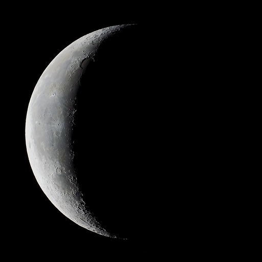
Moon Phase
Waning crescent
Sunset
08:53 PM
Hourly Forecast
Thu, 07:00 AM
SunnyWinds: 10 mph S
76°
Thu, 08:00 AM
SunnyWinds: 15 mph S
77°
Thu, 09:00 AM
SunnyWinds: 15 mph S
80°
Thu, 10:00 AM
SunnyWinds: 15 mph S
84°
Thu, 11:00 AM
SunnyWinds: 15 mph S
88°
Thu, 12:00 PM
SunnyWinds: 15 mph S
91°
Thu, 01:00 PM
SunnyWinds: 15 mph S
93°
Thu, 02:00 PM
SunnyWinds: 15 mph S
97°
Thu, 03:00 PM
SunnyWinds: 15 mph S
98°
Thu, 04:00 PM
SunnyWinds: 15 mph S
100°
Thu, 05:00 PM
SunnyWinds: 15 mph S
100°
Thu, 06:00 PM
Mostly ClearWinds: 15 mph S
101°
Thu, 07:00 PM
ClearWinds: 15 mph S
100°
Thu, 08:00 PM
ClearWinds: 15 mph S
97°
Thu, 09:00 PM
Mostly ClearWinds: 15 mph S
94°
Thu, 10:00 PM
ClearWinds: 15 mph S
91°
Thu, 11:00 PM
Mostly ClearWinds: 15 mph S
89°
Fri, 12:00 AM
ClearWinds: 15 mph S
86°
Fri, 01:00 AM
ClearWinds: 15 mph S
84°
Fri, 02:00 AM
ClearWinds: 15 mph S
82°
Fri, 03:00 AM
Mostly ClearWinds: 15 mph S
81°
Fri, 04:00 AM
Mostly ClearWinds: 15 mph S
80°
Fri, 05:00 AM
Mostly ClearWinds: 15 mph S
78°
Fri, 06:00 AM
SunnyWinds: 15 mph S
77°
Winds: 10 to 15 mph S
Sunny, with a high near 101. South wind 10 to 15 mph.
Winds: 15 mph S
Mostly clear, with a low around 76. South wind around 15 mph.
Winds: 15 to 20 mph S
Sunny, with a high near 100. South wind 15 to 20 mph.
Winds: 10 to 15 mph S
Clear, with a low around 76. South wind 10 to 15 mph.
Winds: 10 mph SE
Sunny, with a high near 99. Southeast wind around 10 mph.
Winds: 10 mph S
Mostly clear, with a low around 76.
Winds: 5 to 10 mph S
A chance of showers and thunderstorms after 1pm. Sunny, with a high near 98.
Winds: 5 to 10 mph SE
A chance of showers and thunderstorms before 1am, then a chance of showers and thunderstorms. Partly cloudy, with a low around 74.
Winds: 5 to 10 mph SE
A chance of showers and thunderstorms before 7am, then a chance of showers and thunderstorms. Mostly sunny, with a high near 95.
Winds: 5 to 10 mph SE
A chance of showers and thunderstorms. Partly cloudy, with a low around 72.
Winds: 5 to 10 mph SE
A chance of showers and thunderstorms. Mostly sunny, with a high near 94.
Winds: 5 to 10 mph SE
A chance of showers and thunderstorms before 7pm. Partly cloudy, with a low around 72.
Winds: 5 to 10 mph SE
Sunny, with a high near 95.
Winds: 5 to 10 mph S
Mostly clear, with a low around 72.
Oilrig
NWS
Buoy
Fixed Station
USGS
Ship
Other
Search Results
