Marineland Beach, 9600 North Oceanshore Boulevard, FL
07/03/2025 10:00 PM
79°F
TEMPERATURE
Winds 5 mph S
Slight Chance Showers And Thunderstorms
A slight chance of showers and thunderstorms before 11pm. Mostly cloudy, with a low around 75. West wind around 5 mph. Chance of precipitation is 20%. New rainfall amounts less than a tenth of an inch possible.
Moonrise
03:24 PM
Moonset
02:17 AM
Sunrise
06:28 AM
Moon Phase
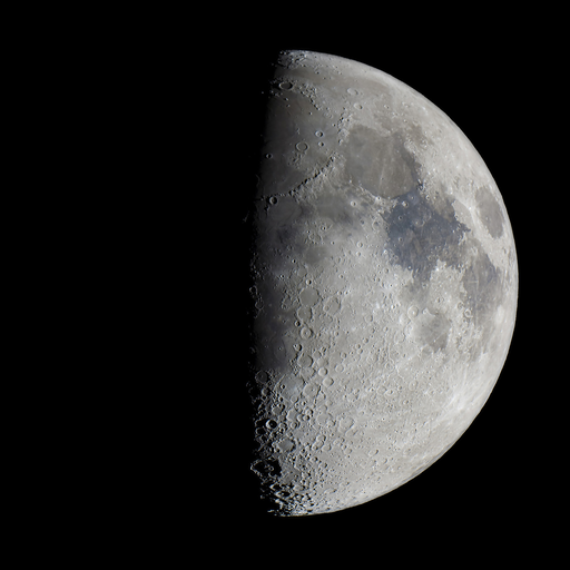
Waxing gibbous
Sunset
08:30 PM

Hourly Forecast

Thu, 10:00 PM

Slight Chance Showers And Thunderstorms
Winds: 5 mph S
79°

Thu, 11:00 PM

Mostly Cloudy
Winds: 3 mph SW
78°

Fri, 12:00 AM

Mostly Cloudy
Winds: 3 mph SW
78°

Fri, 01:00 AM

Mostly Cloudy
Winds: 3 mph W
77°

Fri, 02:00 AM

Mostly Cloudy
Winds: 3 mph W
77°

Fri, 03:00 AM

Mostly Cloudy
Winds: 3 mph W
76°

Fri, 04:00 AM

Mostly Cloudy
Winds: 3 mph W
76°

Fri, 05:00 AM

Mostly Cloudy
Winds: 3 mph W
75°

Fri, 06:00 AM

Partly Sunny
Winds: 3 mph NW
75°

Fri, 07:00 AM

Partly Sunny
Winds: 3 mph W
75°

Fri, 08:00 AM

Mostly Sunny
Winds: 3 mph NW
76°

Fri, 09:00 AM

Mostly Sunny
Winds: 3 mph NW
80°

Fri, 10:00 AM

Sunny
Winds: 5 mph NE
82°

Fri, 11:00 AM

Slight Chance Showers And Thunderstorms
Winds: 7 mph NE
83°

Fri, 12:00 PM

Chance Showers And Thunderstorms
Winds: 7 mph NE
84°

Fri, 01:00 PM

Chance Showers And Thunderstorms
Winds: 8 mph NE
83°

Fri, 02:00 PM

Showers And Thunderstorms Likely
Winds: 9 mph NE
82°

Fri, 03:00 PM

Showers And Thunderstorms Likely
Winds: 10 mph NE
82°

Fri, 04:00 PM

Showers And Thunderstorms Likely
Winds: 10 mph NE
82°

Fri, 05:00 PM

Showers And Thunderstorms Likely
Winds: 10 mph NE
80°

Fri, 06:00 PM

Chance Showers And Thunderstorms
Winds: 9 mph NE
80°

Fri, 07:00 PM

Chance Showers And Thunderstorms
Winds: 8 mph NE
80°

Fri, 08:00 PM

Chance Showers And Thunderstorms
Winds: 7 mph E
80°

Fri, 09:00 PM

Chance Showers And Thunderstorms
Winds: 6 mph NE
79°
Winds: 5 mph W
A slight chance of showers and thunderstorms before 11pm. Mostly cloudy, with a low around 75. West wind around 5 mph. Chance of precipitation is 20%. New rainfall amounts less than a tenth of an inch possible.
Winds: 3 to 10 mph N
Showers and thunderstorms likely after 11am. Mostly sunny. High near 85, with temperatures falling to around 80 in the afternoon. North wind 3 to 10 mph. Chance of precipitation is 70%. New rainfall amounts less than a tenth of an inch possible.
Winds: 5 to 9 mph E
A chance of showers and thunderstorms. Mostly cloudy, with a low around 75. East wind 5 to 9 mph. Chance of precipitation is 50%. New rainfall amounts less than a tenth of an inch possible.
Winds: 7 to 13 mph NE
Showers and thunderstorms. Partly sunny, with a high near 84. Northeast wind 7 to 13 mph, with gusts as high as 17 mph. Chance of precipitation is 80%.
Winds: 6 to 10 mph NW
Showers and thunderstorms before 2am. Mostly cloudy, with a low around 75. Northwest wind 6 to 10 mph. Chance of precipitation is 80%.
Winds: 7 to 12 mph S
Showers and thunderstorms likely after 8am. Mostly sunny, with a high near 88. Chance of precipitation is 70%.
Winds: 6 to 9 mph S
Showers and thunderstorms likely before 8pm. Mostly cloudy, with a low around 76. Chance of precipitation is 70%.
Winds: 6 to 10 mph S
A chance of showers and thunderstorms after 8am. Partly sunny, with a high near 90. Chance of precipitation is 50%.
Winds: 6 to 9 mph SW
A chance of showers and thunderstorms before 8pm. Mostly cloudy, with a low around 76. Chance of precipitation is 50%.
Winds: 6 to 10 mph SW
A chance of showers and thunderstorms after 8am. Partly sunny, with a high near 90. Chance of precipitation is 40%.
Winds: 6 to 10 mph S
A chance of showers and thunderstorms before 2am. Partly cloudy, with a low around 76. Chance of precipitation is 40%.
Winds: 6 to 12 mph SW
A chance of showers and thunderstorms after 8am. Sunny, with a high near 90. Chance of precipitation is 50%.
Winds: 7 to 12 mph S
A chance of showers and thunderstorms before 2am. Partly cloudy, with a low around 76. Chance of precipitation is 50%.
Winds: 7 to 12 mph S
Showers and thunderstorms likely after 8am. Partly sunny, with a high near 91.

Coastal Waters Forecast for Northeast Florida/Southeast Georgia

National Weather Service Jacksonville FL

Atlantic Coastal Waters from Altamaha Sound GA to Flagler Beach FL out to 60 nm. Seas are provided as a range of the average height of the highest 1/3 of the waves, along with the occasional height of the average highest 1/10 of the waves. A weakening frontal boundary over Georgia will continue shifting southward into the local Georgia waters tonight. The boundary will stall tonight into the holiday weekend bringing waves of showers and thunderstorms. A weak area of low pressure will develop along the frontal boundary and move over the coastal waters on Friday. The low will linger over the coastal waters this weekend potentially bringing Small Craft Advisory conditions before lifting northward by early next week. The National Hurricane Center is currently monitoring this system to see if the low will become a tropical or subtropical depression. GULF STREAM. The approximate location of the west wall of the Gulf Stream as of Jul 01, 2025 at 1200 UTC. 56 nautical miles east northeast of Flagler Beach. 59 nautical miles east of Saint Augustine Beach. 68 nautical miles east of Jacksonville Beach. 89 nautical miles east southeast of St Simons Island. This data courtesy of the Naval Oceanographic Office.

REST OF TONIGHT
South winds 5 to 10 knots, becoming west Seas around 2 feet Wave Detail: Southeast 2 feet at 8 seconds Intracoastal waters light chop A slight chance of showers and thunderstorms
FRIDAY
Northeast winds 5 to 10 knots Seas 2 to 3 feet Wave Detail: Southeast 3 feet at 8 seconds Intracoastal waters light chop A chance of showers and thunderstorms
FRIDAY NIGHT
East winds 5 to 10 knots, increasing to 10 to 15 knots after midnight Seas 2 to 3 feet Wave Detail: Southeast 3 feet at 8 seconds Intracoastal waters a moderate chop Showers likely with a chance of thunderstorms
SATURDAY
Northeast winds 10 to 15 knots Seas 2 to 4 feet, occasionally to 5 feet Wave Detail: Northeast 2 feet at 4 seconds and southeast 2 feet at 8 seconds Intracoastal waters a moderate chop Showers and thunderstorms
SATURDAY NIGHT
North winds 10 to 15 knots, becoming west after midnight Seas 2 to 4 feet, occasionally to 5 feet Wave Detail: Northeast 2 feet at 5 seconds and southeast 2 feet at 8 seconds Intracoastal waters a moderate chop A chance of showers and thunderstorms, mainly in the evening
SUNDAY
Southwest winds around 10 knots, becoming south in the afternoon Seas 2 to 3 feet Wave Detail: Northeast 2 feet at 7 seconds and southeast 2 feet at 8 seconds Intracoastal waters light chop A chance of thunderstorms A chance of showers in the morning, then showers likely in the afternoon
SUNDAY NIGHT
Southwest winds around 10 knots Seas 2 to 3 feet Intracoastal waters light chop A slight chance of showers and thunderstorms in the evening
MONDAY THROUGH TUESDAY
Southwest winds 5 to 10 knots Seas 2 to 3 feet Intracoastal waters light chop A chance of showers and thunderstorms
Reporting time 09:04 PM EDT Thu Jul 3 2025
REST OF TONIGHT
South winds 5 to 10 knots Seas 2 to 3 feet Wave Detail: Southeast 3 feet at 8 seconds A slight chance of showers and thunderstorms this evening, then a chance of showers and thunderstorms
FRIDAY
North winds 5 to 10 knots, becoming northeast in the afternoon Seas 2 to 3 feet Wave Detail: Southeast 3 feet at 8 seconds A chance of showers and thunderstorms
FRIDAY NIGHT
Southeast winds 5 to 10 knots, increasing to 10 to 15 knots after midnight Seas 2 to 3 feet Wave Detail: Southeast 3 feet at 8 seconds A chance of thunderstorms Showers
SATURDAY
East winds 10 to 15 knots Seas 3 to 4 feet, occasionally to 5 feet Wave Detail: Northeast 3 feet at 5 seconds and southeast 3 feet at 8 seconds A chance of thunderstorms Showers
SATURDAY NIGHT
Southeast winds 10 to 15 knots, becoming southwest after midnight Seas 3 to 4 feet, occasionally to 5 feet Wave Detail: Northeast 3 feet at 5 seconds and southeast 3 feet at 8 seconds A chance of thunderstorms Showers likely, mainly in the evening
SUNDAY AND SUNDAY NIGHT
Southwest winds 10 to 15 knots Seas 3 to 4 feet, occasionally to 5 feet Wave Detail: Southeast 3 feet at 8 seconds and northeast 2 feet at 8 seconds A chance of showers with a slight chance of thunderstorms
MONDAY THROUGH TUESDAY
Southwest winds 5 to 10 knots Seas 2 to 3 feet A chance of showers with a slight chance of thunderstorms
Reporting time 09:04 PM EDT Thu Jul 3 2025
Oilrig
NWS
Buoy
Fixed Station
USGS
Ship
Other