Hourly Forecast
Sat, 04:00 AM
Mostly CloudyWinds: 5 mph WSW
Sat, 05:00 AM
Partly CloudyWinds: 5 mph SW
Sat, 06:00 AM
Mostly SunnyWinds: 5 mph SW
Sat, 07:00 AM
Mostly SunnyWinds: 5 mph WSW
Sat, 08:00 AM
Mostly SunnyWinds: 5 mph WSW
Sat, 09:00 AM
Mostly SunnyWinds: 5 mph WSW
Sat, 10:00 AM
Mostly SunnyWinds: 5 mph WSW
Sat, 11:00 AM
Mostly SunnyWinds: 5 mph WSW
Sat, 12:00 PM
Mostly SunnyWinds: 10 mph WSW
Sat, 01:00 PM
Slight Chance Showers And ThunderstormsWinds: 10 mph WSW
Sat, 02:00 PM
Chance Showers And ThunderstormsWinds: 10 mph S
Sat, 03:00 PM
Chance Showers And ThunderstormsWinds: 10 mph S
Sat, 04:00 PM
Chance Showers And ThunderstormsWinds: 10 mph SSW
Sat, 05:00 PM
Showers And Thunderstorms LikelyWinds: 10 mph SSW
Sat, 06:00 PM
Showers And Thunderstorms LikelyWinds: 10 mph S
Sat, 07:00 PM
Chance Showers And ThunderstormsWinds: 5 mph S
Sat, 08:00 PM
Slight Chance Showers And ThunderstormsWinds: 5 mph SSW
Sat, 09:00 PM
Mostly CloudyWinds: 5 mph SSW
Sat, 10:00 PM
Mostly CloudyWinds: 5 mph SW
Sat, 11:00 PM
Mostly CloudyWinds: 5 mph SSW
Sun, 12:00 AM
Mostly CloudyWinds: 5 mph SSW
Sun, 01:00 AM
Mostly CloudyWinds: 5 mph SSW
Sun, 02:00 AM
Mostly CloudyWinds: 5 mph SSW
Sun, 03:00 AM
Mostly CloudyWinds: 5 mph SSW
Coastal Waters Forecast for East Central Florida
National Weather Service Melbourne FL
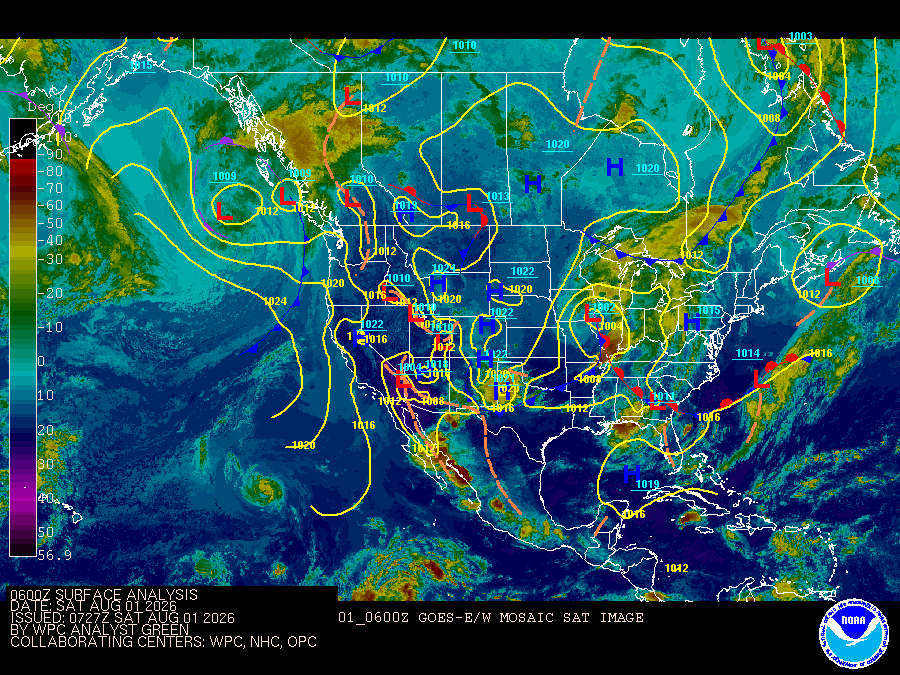
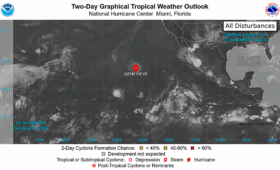
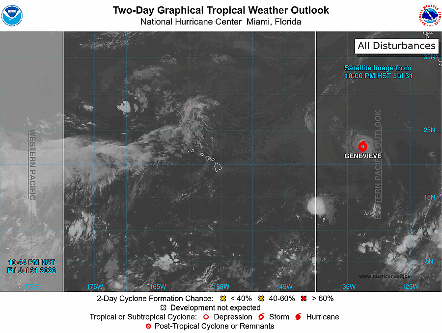
High pressure remains situated south of the local Atlantic this weekend. A nearly-stationary front will stay to the north. Weak to moderate offshore flow persists, but as the sea breeze attempts to form, winds may turn southeasterly in the afternoon near the coast, especially south of Cape Canaveral. Scattered to numerous offshore-moving storms remain the primary hazard for boaters this weekend. Winds freshen some on Sunday, especially in the Gulf Stream. Next week, high pressure will lift slowly northward, with onshore breezes returning by midweek.
Atlantic coastal waters from Flagler Beach to Jupiter Inlet out 60 nm. Seas are provided as a range of the average height of the highest one third of the waves, along with the occasional height of the average highest ten percent of the waves. GULF STREAM HAZARDS.None. The approximate location of the west wall of the Gulf Stream based on the Real Time Ocean Forecast System as of Saturday, August 1st, 2026. 44 nautical miles east of Ponce Inlet. 31 nautical miles east of Port Canaveral. 24 nautical miles east of Sebastian Inlet. 16 nautical miles east of Fort Pierce Inlet. 9 nautical miles east of Saint Lucie Inlet.
Search Results
