Hourly Forecast
Mon, 12:00 PM
Chance Light SnowWinds: 15 mph NE
Mon, 01:00 PM
Chance Light SnowWinds: 14 mph NE
Mon, 02:00 PM
Chance Light SnowWinds: 14 mph NE
Mon, 03:00 PM
Chance Light SnowWinds: 13 mph NE
Mon, 04:00 PM
Chance Light SnowWinds: 13 mph NE
Mon, 05:00 PM
Chance Light SnowWinds: 12 mph NE
Mon, 06:00 PM
Chance Light SnowWinds: 10 mph N
Mon, 07:00 PM
CloudyWinds: 10 mph N
Mon, 08:00 PM
CloudyWinds: 9 mph N
Mon, 09:00 PM
CloudyWinds: 9 mph N
Mon, 10:00 PM
Mostly CloudyWinds: 9 mph N
Mon, 11:00 PM
Mostly CloudyWinds: 8 mph N
Tue, 12:00 AM
Mostly CloudyWinds: 8 mph N
Tue, 01:00 AM
Partly CloudyWinds: 7 mph N
Tue, 02:00 AM
Mostly ClearWinds: 7 mph N
Tue, 03:00 AM
Mostly ClearWinds: 6 mph N
Tue, 04:00 AM
Mostly ClearWinds: 6 mph N
Tue, 05:00 AM
Mostly ClearWinds: 5 mph N
Tue, 06:00 AM
SunnyWinds: 5 mph NE
Tue, 07:00 AM
SunnyWinds: 5 mph NE
Tue, 08:00 AM
SunnyWinds: 3 mph NE
Tue, 09:00 AM
SunnyWinds: 3 mph NE
Tue, 10:00 AM
SunnyWinds: 3 mph NE
Tue, 11:00 AM
SunnyWinds: 5 mph E
Coastal Waters Forecast
National Weather Service Baltimore MD/Washington DC
FOR THE TIDAL POTOMAC AND MD PORTION OF THE CHESAPEAKE BAY.
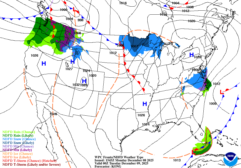
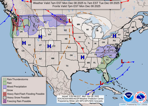
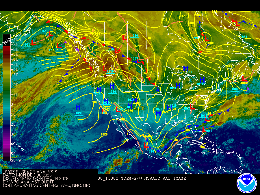
Tidal Potomac River and Maryland portion of Chesapeake Bay. Forecasts of wave heights do not include effects of wind direction relative to tidal currents. Expect higher waves when winds are blowing against the tidal flow. Waves flat where waters are iced over. A potent cold front crosses the waters early this morning. In the wake, a strong area of Canadian high pressure builds over the region this evening into Tuesday. Another clipper-like system moves through the area by mid-week before a secondary cold front crosses the waters on Thursday. Weak high pressure returns by Friday. Small Craft Advisories will likely be needed Tuesday through Wednesday night, and potentially again late Friday.
Search Results
