Brady,
TX
12/08/2025 01:00 PM
57°F
TEMPERATURE
Winds 5 mph E
Sunny
Sunny. High near 62, with temperatures falling to around 56 in the afternoon. Southeast wind around 5 mph.
Moonrise
09:50 PM
Moonset
11:06 AM
Sunrise
07:23 AM
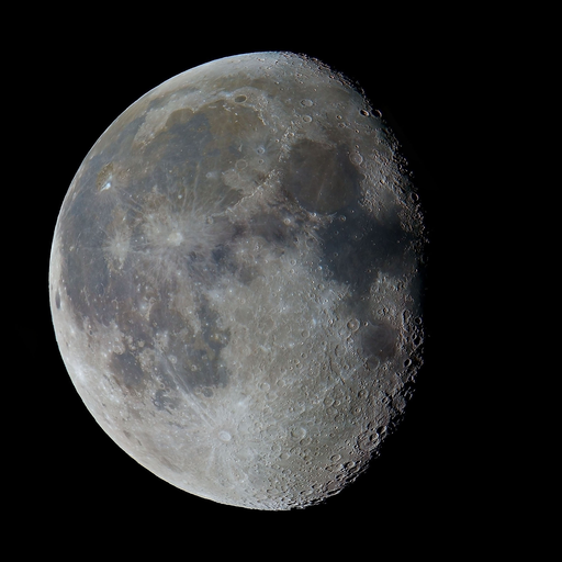
Moon Phase
Waning gibbous
Sunset
05:35 PM
Hourly Forecast
Mon, 01:00 PM
SunnyWinds: 5 mph E
57°
Mon, 02:00 PM
SunnyWinds: 5 mph ESE
59°
Mon, 03:00 PM
SunnyWinds: 5 mph SE
60°
Mon, 04:00 PM
SunnyWinds: 5 mph SE
59°
Mon, 05:00 PM
SunnyWinds: 5 mph SE
56°
Mon, 06:00 PM
ClearWinds: 5 mph SE
53°
Mon, 07:00 PM
ClearWinds: 5 mph SE
49°
Mon, 08:00 PM
ClearWinds: 5 mph SE
47°
Mon, 09:00 PM
ClearWinds: 5 mph SSE
46°
Mon, 10:00 PM
ClearWinds: 5 mph S
45°
Mon, 11:00 PM
Mostly ClearWinds: 5 mph S
44°
Tue, 12:00 AM
ClearWinds: 5 mph S
42°
Tue, 01:00 AM
ClearWinds: 5 mph S
42°
Tue, 02:00 AM
ClearWinds: 5 mph SSW
41°
Tue, 03:00 AM
ClearWinds: 5 mph SSW
40°
Tue, 04:00 AM
ClearWinds: 5 mph SSW
40°
Tue, 05:00 AM
ClearWinds: 5 mph SSW
39°
Tue, 06:00 AM
SunnyWinds: 5 mph SSW
38°
Tue, 07:00 AM
SunnyWinds: 10 mph SW
37°
Tue, 08:00 AM
SunnyWinds: 10 mph SSW
39°
Tue, 09:00 AM
SunnyWinds: 10 mph SSW
48°
Tue, 10:00 AM
SunnyWinds: 15 mph SW
53°
Tue, 11:00 AM
SunnyWinds: 15 mph SW
59°
Tue, 12:00 PM
SunnyWinds: 15 mph SW
64°
Winds: 5 mph SE
Sunny. High near 62, with temperatures falling to around 56 in the afternoon. Southeast wind around 5 mph.
Winds: 5 mph S
Clear, with a low around 37. South wind around 5 mph.
Winds: 5 to 15 mph SW
Sunny. High near 70, with temperatures falling to around 67 in the afternoon. Southwest wind 5 to 15 mph.
Winds: 10 to 15 mph SW
Clear, with a low around 46. Southwest wind 10 to 15 mph.
Winds: 10 to 15 mph NNW
Sunny, with a high near 68. North northwest wind 10 to 15 mph.
Winds: 0 to 5 mph NW
Clear, with a low around 38. Northwest wind 0 to 5 mph.
Winds: 5 to 10 mph SW
Sunny, with a high near 73. Southwest wind 5 to 10 mph.
Winds: 5 mph SSW
Mostly clear, with a low around 47. South southwest wind around 5 mph.
Winds: 5 to 10 mph W
Sunny, with a high near 74. West wind 5 to 10 mph.
Winds: 5 to 10 mph NNE
Partly cloudy, with a low around 41. North northeast wind 5 to 10 mph.
Winds: 5 to 10 mph SE
Mostly sunny, with a high near 65.
Winds: 5 mph SSE
Partly cloudy, with a low around 47.
Winds: 5 to 10 mph SE
Partly sunny, with a high near 66.
Winds: 10 mph SSE
Mostly cloudy, with a low around 50.
Coastal Waters Forecast for Texas
National Weather Service Corpus Christi TX
FOR THE MIDDLE TEXAS COASTAL WATERS.
Middle Texas coastal waters from Baffin Bay to Matagorda ship channel out to 60 nautical miles. Seas are provided as a range of the average height of the highest 1/3 of the waves.along with occasional height of the average highest 10 percent of the waves. A fresh (BF 5) north to northeast flow across the coastal waters will decrease to a gentle to moderate (BF 3-4) breeze tonight. Northeasterly winds will gradually shift southeast to south by Tuesday, becoming gentle to moderate once again. Another cold front is expected by the weekend along with a 20-30% chance of showers and thunderstorms.
TONIGHT
Northeast winds 5 to 10 knots Bay and inland waters smooth to slightly choppy
TUESDAY
Northeast winds around 5 knots, becoming southeast around 5 knots in the afternoon Bay and inland waters smooth
TUESDAY NIGHT
South winds 5 to 10 knots Bay and inland waters smooth
WEDNESDAY
Southwest winds around 5 knots, becoming south in the afternoon Bay and inland waters smooth
WEDNESDAY NIGHT
Southeast winds around 5 knots, becoming northeast after midnight Bay and inland waters smooth
THURSDAY
Northeast winds around 5 knots, becoming southeast in the afternoon Bay and inland waters smooth
THURSDAY NIGHT
South winds 5 to 10 knots Bay and inland waters smooth
FRIDAY
South winds 5 to 10 knots Bay and inland waters smooth
FRIDAY NIGHT
Southeast winds 5 to 10 knots Bay and inland waters smooth A chance of showers after midnight
SATURDAY
East winds 10 to 15 knots Bay and inland waters slightly choppy to occasionally choppy
SATURDAY NIGHT
East winds 10 to 15 knots Bay and inland waters slightly choppy to occasionally choppy
TONIGHT
Northeast winds 5 to 10 knots Bay and inland waters smooth to slightly choppy
TUESDAY
Northeast winds 5 to 10 knots, becoming east in the afternoon Bay and inland waters smooth
TUESDAY NIGHT
South winds 5 to 10 knots Bay and inland waters smooth
WEDNESDAY
Southwest winds 5 to 10 knots, becoming south in the afternoon Bay and inland waters smooth
WEDNESDAY NIGHT
Southeast winds 5 to 10 knots, becoming southwest after midnight Bay and inland waters smooth
THURSDAY
North winds 5 to 10 knots, becoming southeast in the afternoon Bay and inland waters smooth
THURSDAY NIGHT
South winds 10 to 15 knots Bay and inland waters slightly choppy to occasionally choppy
FRIDAY
South winds 5 to 10 knots, becoming southeast 10 to 15 knots in the afternoon Bay and inland waters slightly choppy to occasionally choppy
FRIDAY NIGHT
Southeast winds 10 to 15 knots Bay and inland waters slightly choppy to occasionally choppy A chance of showers after midnight
SATURDAY
Southeast winds 10 to 15 knots, becoming east 15 to 20 knots in the afternoon Bay and inland waters choppy A chance of showers in the morning
SATURDAY NIGHT
East winds 15 to 20 knots, diminishing to 10 to 15 knots after midnight Bay and inland waters choppy
TONIGHT
Northeast winds 10 to 15 knots decreasing to 5 to 10 knots after midnight Seas 2 to 3 feet Wave Detail: Northeast 3 feet at 6 seconds
TUESDAY
Northeast winds 5 to 10 knots, becoming east in the afternoon Seas around 2 feet Wave Detail: East 2 feet at 6 seconds
TUESDAY NIGHT
South winds 5 to 10 knots, becoming around 10 knots after midnight Seas around 2 feet Wave Detail: Southeast 2 feet at 5 seconds
WEDNESDAY
Southwest winds 5 to 10 knots Seas around 2 feet Wave Detail: Southeast 2 feet at 5 seconds
WEDNESDAY NIGHT
Southeast winds 5 to 10 knots, becoming southwest after midnight Seas around 2 feet Wave Detail: Southeast 1 foot at 5 seconds
THURSDAY
Northeast winds 5 to 10 knots, becoming east in the afternoon Seas around 2 feet Wave Detail: Northeast 1 foot at 3 seconds and southeast 1 foot at 5 seconds
THURSDAY NIGHT
South winds 5 to 10 knots Seas around 2 feet
FRIDAY
South winds 5 to 10 knots Seas around 2 feet
FRIDAY NIGHT
Southeast winds 10 to 15 knots Seas 2 to 3 feet A chance of showers after midnight
SATURDAY
East winds 15 to 20 knots Seas 3 to 5 feet, occasionally to 6 feet A chance of showers in the morning
SATURDAY NIGHT
East winds 10 to 15 knots Seas 2 to 3 feet
TONIGHT
Northeast winds 10 to 15 knots, diminishing to 5 to 10 knots after midnight Seas 2 to 4 feet, occasionally to 5 feet Wave Detail: Northeast 4 feet at 7 seconds and north 1 foot at 3 seconds
TUESDAY
Northeast winds 5 to 10 knots, becoming east in the afternoon Seas around 2 feet Wave Detail: East 2 feet at 6 seconds
TUESDAY NIGHT
South winds 5 to 10 knots, increasing to 10 to 15 knots after midnight Seas 2 to 3 feet Wave Detail: South 2 feet at 4 seconds and east 2 feet at 6 seconds
WEDNESDAY
Southwest winds 10 to 15 knots, becoming south 5 to 10 knots in the afternoon Seas 2 to 3 feet Wave Detail: South 2 feet at 4 seconds and east 2 feet at 7 seconds
WEDNESDAY NIGHT
Southeast winds around 10 knots, becoming southwest after midnight Seas around 2 feet Wave Detail: Southeast 2 feet at 5 seconds
THURSDAY
West winds 5 to 10 knots, becoming southeast in the afternoon Seas around 2 feet Wave Detail: Southwest 1 foot at 4 seconds and east 1 foot at 6 seconds
THURSDAY NIGHT
South winds 10 to 15 knots Seas around 2 feet
FRIDAY
South winds 10 to 15 knots Seas 2 to 3 feet
FRIDAY NIGHT
Southeast winds around 15 knots Seas 3 to 4 feet, occasionally to 5 feet A chance of showers after midnight
SATURDAY
East winds 15 to 20 knots Seas 3 to 5 feet, occasionally to 6 feet A chance of showers in the morning
SATURDAY NIGHT
East winds 15 to 20 knots Seas 2 to 3 feet
SMALL CRAFT SHOULD EXERCISE CAUTION
Reporting time
Oilrig
NWS
Buoy
Fixed Station
USGS
Ship
Other
Search Results
