Hourly Forecast
Mon, 04:00 PM
Partly SunnyWinds: 15 mph N
Mon, 05:00 PM
Mostly CloudyWinds: 16 mph N
Mon, 06:00 PM
Mostly CloudyWinds: 16 mph N
Mon, 07:00 PM
Mostly CloudyWinds: 16 mph N
Mon, 08:00 PM
Mostly CloudyWinds: 16 mph N
Mon, 09:00 PM
Mostly CloudyWinds: 15 mph N
Mon, 10:00 PM
Mostly CloudyWinds: 15 mph NNE
Mon, 11:00 PM
Mostly CloudyWinds: 15 mph NNE
Tue, 12:00 AM
Mostly CloudyWinds: 16 mph NNE
Tue, 01:00 AM
Mostly CloudyWinds: 16 mph NNE
Tue, 02:00 AM
Mostly CloudyWinds: 17 mph NNE
Tue, 03:00 AM
Mostly CloudyWinds: 17 mph NNE
Tue, 04:00 AM
Mostly CloudyWinds: 17 mph NNE
Tue, 05:00 AM
Mostly CloudyWinds: 16 mph NNE
Tue, 06:00 AM
Partly SunnyWinds: 16 mph NE
Tue, 07:00 AM
Partly SunnyWinds: 15 mph NE
Tue, 08:00 AM
Mostly SunnyWinds: 14 mph NE
Tue, 09:00 AM
Mostly SunnyWinds: 13 mph NE
Tue, 10:00 AM
Mostly SunnyWinds: 13 mph NE
Tue, 11:00 AM
SunnyWinds: 12 mph NE
Tue, 12:00 PM
Mostly SunnyWinds: 12 mph NE
Tue, 01:00 PM
Mostly SunnyWinds: 12 mph NNE
Tue, 02:00 PM
Mostly SunnyWinds: 12 mph NNE
Tue, 03:00 PM
Mostly SunnyWinds: 12 mph NNE
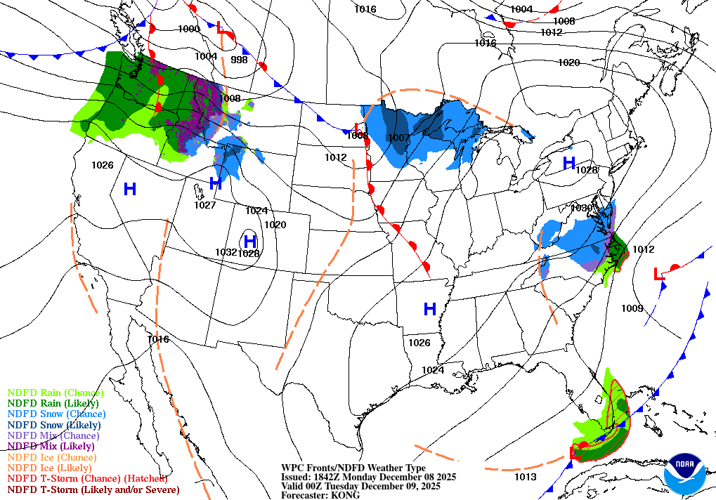
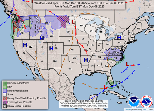
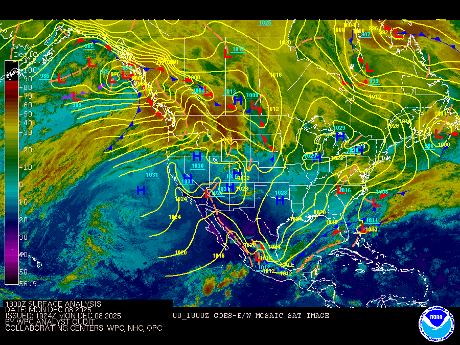
Coastal Waters Forecast for Florida
National Weather Service Tampa Bay Ruskin FL
Gulf coastal waters from Bonita Beach to the mouth of the Suwannee River out to 60 NM. Important notice to mariners.marine forecasts are issued at least four times a day. Boaters on extended trips should routinely monitor subsequent forecast issuances and updates for the latest marine weather information. The wave heights are forecast as significant wave height which is the average of the highest one-third of the waves. The highest waves may rarely be twice the significant wave height. The winds and seas near thunderstorms may be higher than forecast. N/NE winds expected to increase through the day, especially over the waters, necessitating a Small Craft Advisory through tomorrow morning. A few showers continue to develop and move over the coastal waters this afternoon. Conditions improve tomorrow afternoon and remain pleasant through the remainder of the week. Another front is expected to move through the area next weekend, increasing winds once again. &&
Search Results
